MyTopo
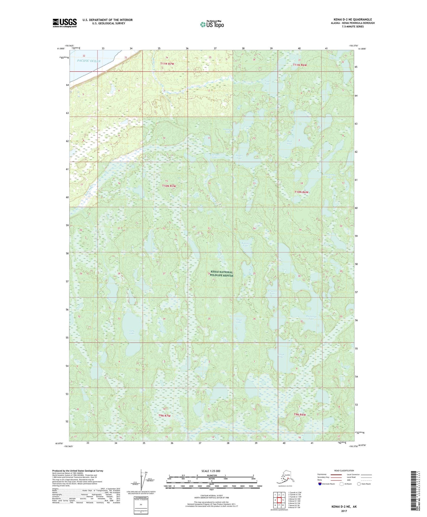
Kenai D-2 NE Alaska US Topo Map
Couldn't load pickup availability
2017 topographic map quadrangle Kenai D-2 NE in the state of Alaska. Scale: 1:25000. Print Size: 24" x 29"
Based on the newly updated USGS 7.5' US Topo series, this map has UTM / MGRS grids and is in the following counties: Kenai Peninsula.
The map contains contour data, water features, and other items you are used to seeing on U.S. Geological Survey maps, but also has updated roads and other features. This is the next generation of topographic maps. Printed on high-quality waterproof paper with UV fade-resistant inks.
Contains the following named places: Angler Lake, Bird Lake, Kakoon Lake, Kenaitze Lake, Kraenberi Lake, Kuguyuk Lake, Lark Lake, Neckshortka Lake, Norak Lake, Phalarope Lake, Taiga Lake, Vogel Lake, Twig Lake