MyTopo
Ketchikan A-5 NW Alaska US Topo Map
Couldn't load pickup availability
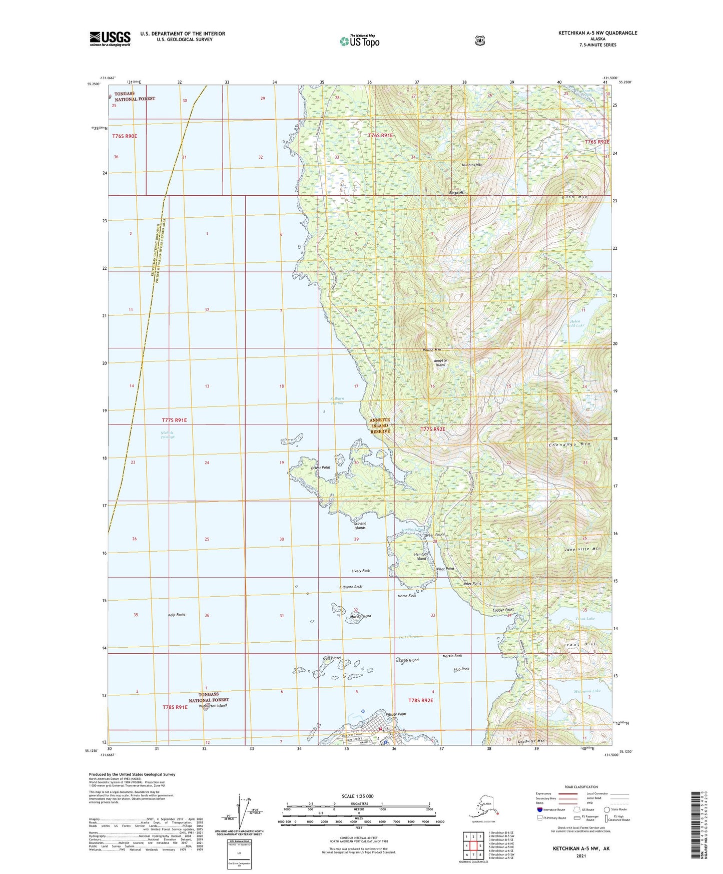
2021 topographic map quadrangle Ketchikan A-5 NW in the state of Alaska. Scale: 1:25000. Print Size: 24" x 29"
Based on the newly updated USGS 7.5' US Topo series, this map has UTM / MGRS grids and is in the following counties: Prince of Wales-Hyder (CA), Ketchikan Gateway.
The map contains contour data, water features, and other items you are used to seeing on U.S. Geological Survey maps, but also has updated roads and other features. This is the next generation of topographic maps. Printed on high-quality waterproof paper with UV fade-resistant inks.
Contains the following named places: Scrub Island, Sylburn Harbor, Trout Hill, Village Point, Warburton Island, Metlakatla Seaplane Base, Helen Todd Lake, Hemlock Bay, Bingo Mountain, Bush Mountain, Chenango Mountain, Copper Point, Driest Point, Fillmore Rock, Green Point, Gull Island, Hemlock Island, Hub Rock, Inlet Point, Janesville Mountain, Kelp Rocks, Leadville Mountain, Lively Rock, Martin Rock, Melanson Lake, Metlakatla, Morse Rock, Murdo Island, Nichols Passage, Nubbins Mountain, Pilot Point, Port Chester, Round Mountain, Gravina Islands, Metlakatla Volunteer Fire Department, Indian Health Service Annette Island Service Unit, Metlakatla Post Office, Metlakatla Police Department