MyTopo
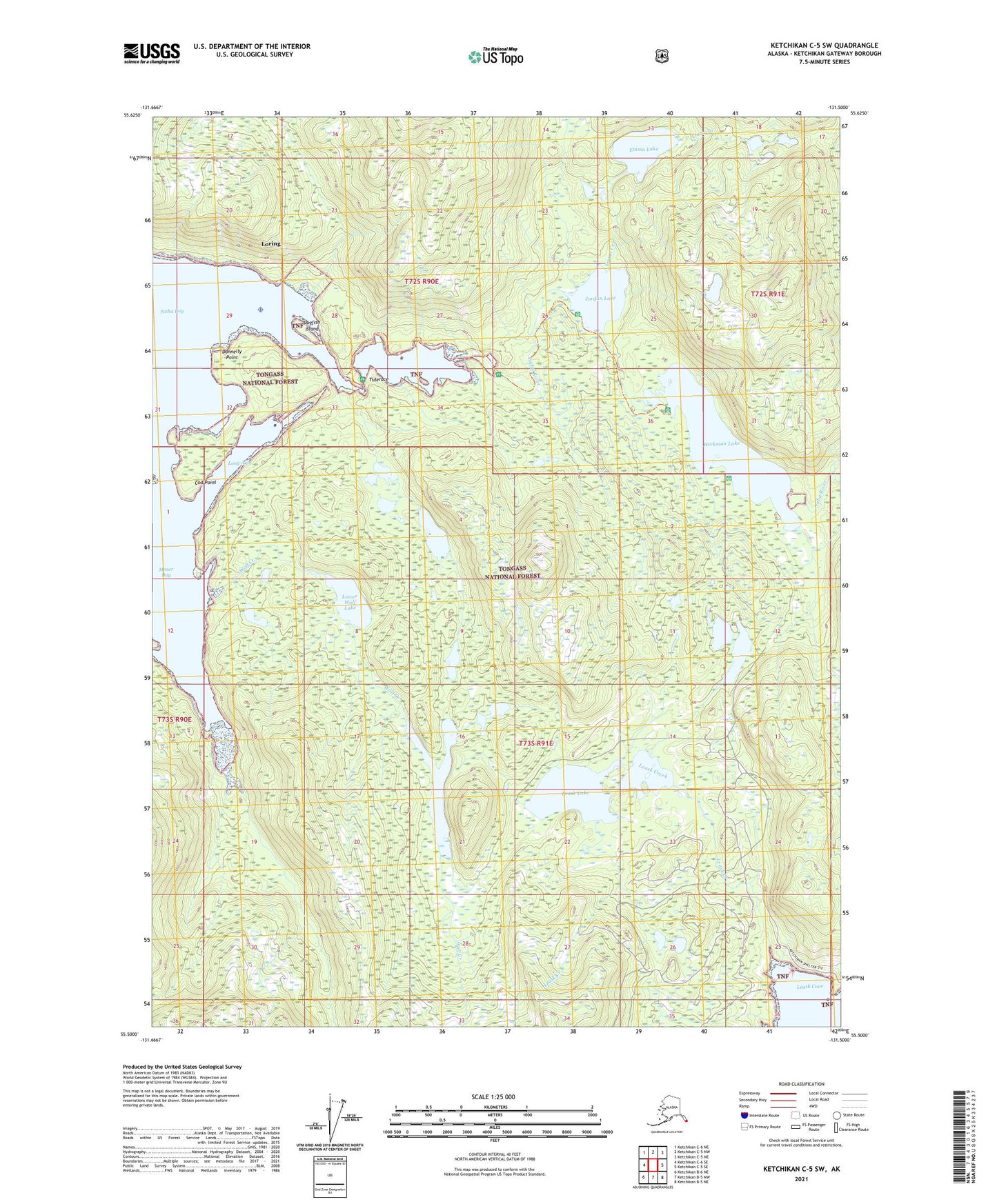
Ketchikan C-5 SW Alaska US Topo Map
Couldn't load pickup availability
2021 topographic map quadrangle Ketchikan C-5 SW in the state of Alaska. Scale: 1:25000. Print Size: 24" x 29"
Based on the newly updated USGS 7.5' US Topo series, this map has UTM / MGRS grids and is in the following counties: Ketchikan Gateway.
The map contains contour data, water features, and other items you are used to seeing on U.S. Geological Survey maps, but also has updated roads and other features. This is the next generation of topographic maps. Printed on high-quality waterproof paper with UV fade-resistant inks.
Contains the following named places: Tiderace, Upper Wolf Lake, Wolf Creek, Loring Seaplane Base, Black Bear Observation Post, Cod Point, Dogfish Island, Donnelly Point, Emma Creek, Emma Lake, Heckman Lake, Jordan Lake, Leask Cove, Leask Creek, Leask Lake, Long Arm, Loring, Lower Wolf Lake, Moser Bay, Naha Bay, Naha River, Orton Ranch, Roosevelt Lagoon, Loring Census Designated Place