MyTopo
Kodiak A-4 NW Alaska US Topo Map
Couldn't load pickup availability
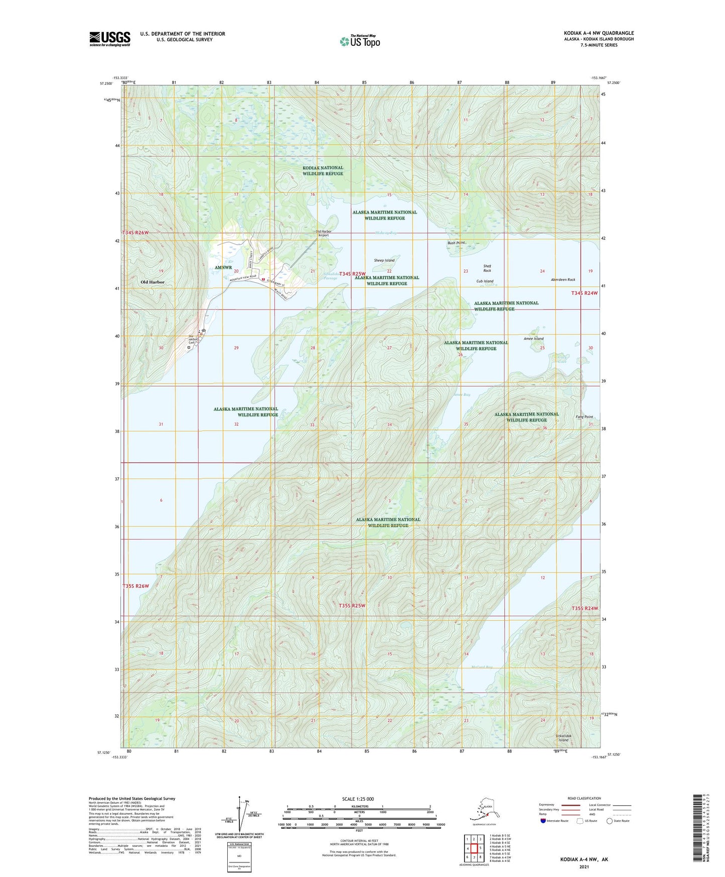
2021 topographic map quadrangle Kodiak A-4 NW in the state of Alaska. Scale: 1:25000. Print Size: 24" x 29"
Based on the newly updated USGS 7.5' US Topo series, this map has UTM / MGRS grids and is in the following counties: Kodiak Island.
The map contains contour data, water features, and other items you are used to seeing on U.S. Geological Survey maps, but also has updated roads and other features. This is the next generation of topographic maps. Printed on high-quality waterproof paper with UV fade-resistant inks.
Contains the following named places: Aberdeen Rock, Amee Bay, Amee Island, Bush Point, Cozy Cove, Cub Island, McCord (historical), McCord Bay, Midway Bay, Old Harbor, Old Harbor Light, Shag Rock, Sheep Island, Sitkalidak Island, Sitkalidak Passage, Old Harbor City Dam, Old Harbor Airport, Old Harbor Alaska Native Village Statistical Area, City of Old Harbor, Old Harbor Volunteer Fire Department, Kodiak Area Native Association Old Harbor Health Clinic, Old Harbor Post Office, Old Harbor Cemetery