MyTopo
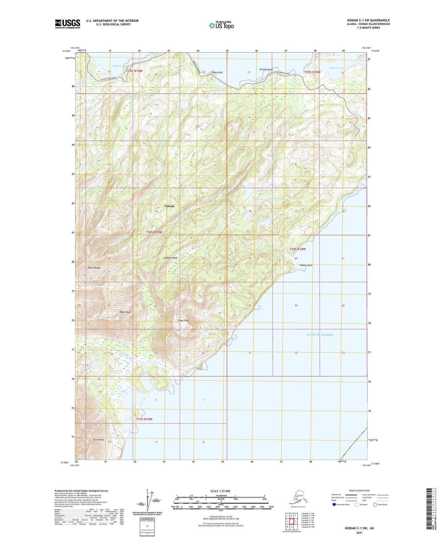
Kodiak C-1 SW Alaska US Topo Map
Couldn't load pickup availability
2021 topographic map quadrangle Kodiak C-1 SW in the state of Alaska. Scale: 1:25000. Print Size: 24" x 29"
Based on the newly updated USGS 7.5' US Topo series, this map has UTM / MGRS grids and is in the following counties: Kodiak Island.
The map contains contour data, water features, and other items you are used to seeing on U.S. Geological Survey maps, but also has updated roads and other features. This is the next generation of topographic maps. Printed on high-quality waterproof paper with UV fade-resistant inks.
Contains the following named places: Boyer Peak, Chiniak Lake, Chiniak Point, Chiniak River, East Fork Twin Creek, Pony Point, Roslyn Creek, Sacramento River, Sawmill Lake, Sequel Point, Slope Peak, Twin Creek, Twin Peaks, West Fork Twin Creek, Hidden Lakes, Jupiter Lake, Saturn Lake, Uranus, Neptune, Chiniak (historical), Chiniak Census Designated Place, Fort J H Smith (historical), Weisser Creek