MyTopo
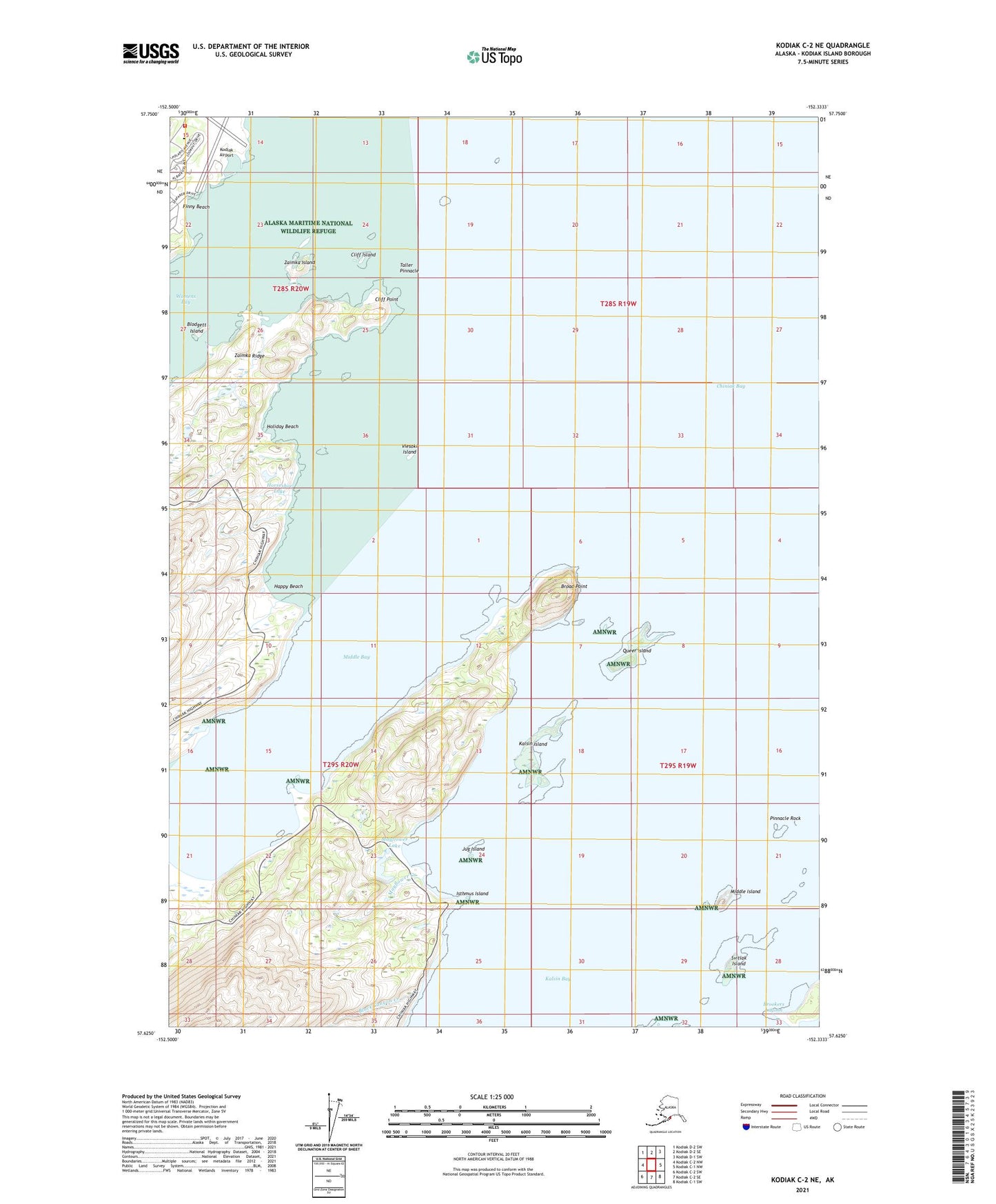
Kodiak C-2 NE Alaska US Topo Map
Couldn't load pickup availability
2021 topographic map quadrangle Kodiak C-2 NE in the state of Alaska. Scale: 1:25000. Print Size: 24" x 29"
Based on the newly updated USGS 7.5' US Topo series, this map has UTM / MGRS grids and is in the following counties: Kodiak Island.
The map contains contour data, water features, and other items you are used to seeing on U.S. Geological Survey maps, but also has updated roads and other features. This is the next generation of topographic maps. Printed on high-quality waterproof paper with UV fade-resistant inks.
Contains the following named places: Blodgett Island, Broad Point, Chiniak Bay, Cliff Island, Cliff Point, Finny Beach, Happy Beach, Holiday Beach, Isthmus Island, Jug Island, Kalsin Bay, Kalsin Island, Mayflower Creek, Middle Island, Pinnacle Rock, Queer Island, Svitlak Island, Taller Pinnacle, Viesoki Island, Zaimka Island, Middle Bay, Horseshoe Lake, Mayflower Lake, Black Canyon Creek, Snag Lake, Kodiak Airport, US Coast Guard Base Kodiak Fire Department, United States Coast Guard Rockmore - King Medical Clinic