MyTopo
Kodiak C-6 NE Alaska US Topo Map
Regular price
$16.95
Regular price
Sale price
$16.95
Unit price
per
Couldn't load pickup availability
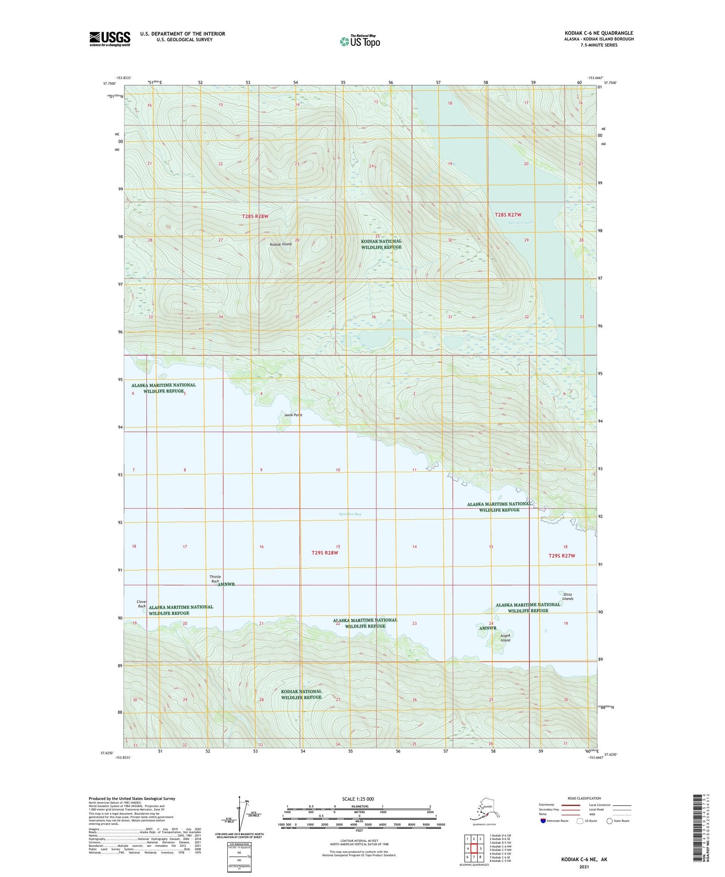
2021 topographic map quadrangle Kodiak C-6 NE in the state of Alaska. Scale: 1:25000. Print Size: 24" x 29"
Based on the newly updated USGS 7.5' US Topo series, this map has UTM / MGRS grids and is in the following counties: Kodiak Island.
The map contains contour data, water features, and other items you are used to seeing on U.S. Geological Survey maps, but also has updated roads and other features. This is the next generation of topographic maps. Printed on high-quality waterproof paper with UV fade-resistant inks.
Contains the following named places: Anguk Island, Clover Rock, Ditto Islands, Hook Point, Spiridon Bay, Spiridon Lake, Thistle Rock, Kodiak Island Borough, Kodiak Island Census Subarea