MyTopo
Kwiguk C-6 SW Alaska US Topo Map
Couldn't load pickup availability
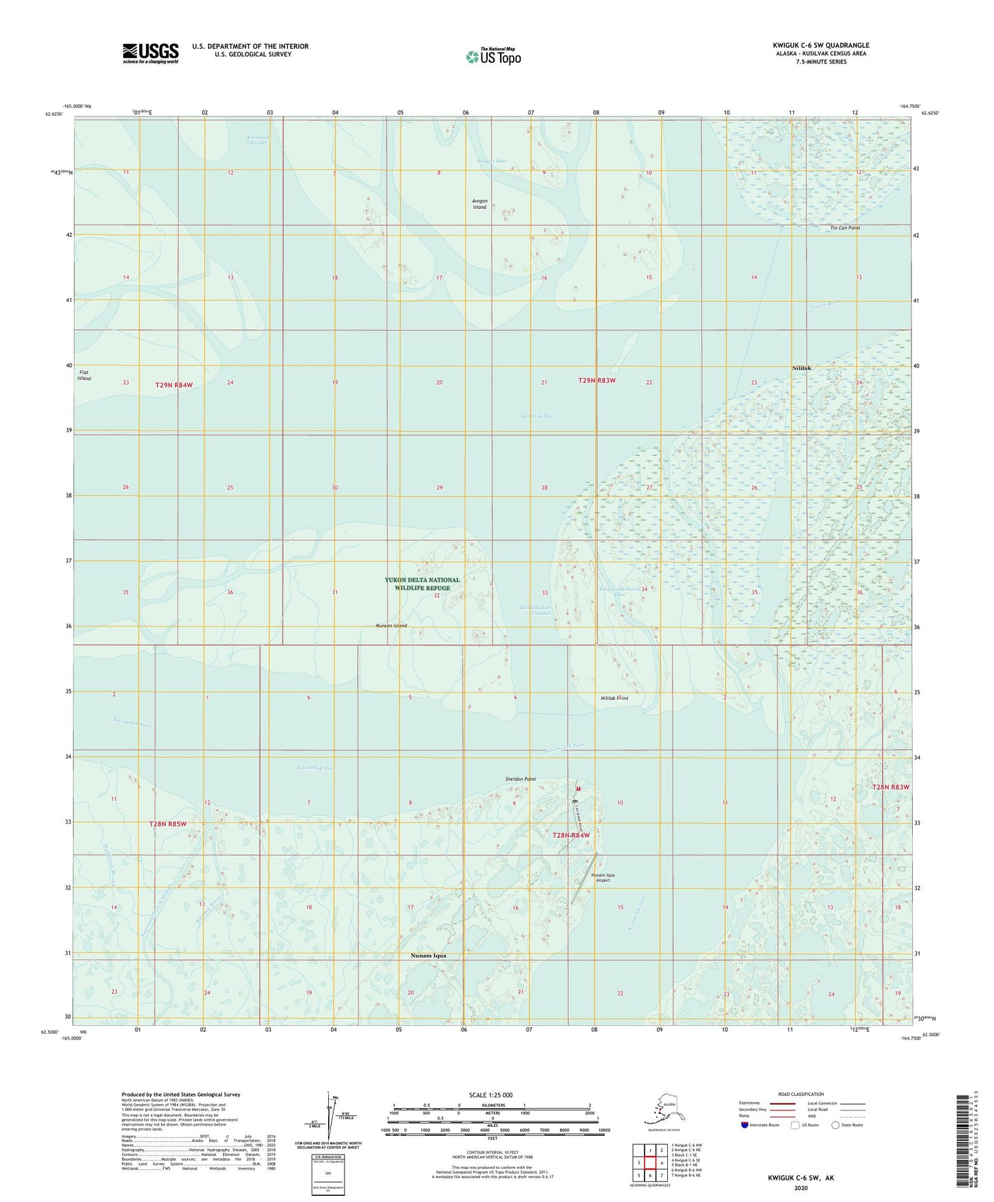
2020 topographic map quadrangle Kwiguk C-6 SW in the state of Alaska. Scale: 1:25000. Print Size: 24" x 29"
Based on the newly updated USGS 7.5' US Topo series, this map has UTM / MGRS grids and is in the following counties: Kusilvak (CA).
The map contains contour data, water features, and other items you are used to seeing on U.S. Geological Survey maps, but also has updated roads and other features. This is the next generation of topographic maps. Printed on high-quality waterproof paper with UV fade-resistant inks.
Contains the following named places: Agcklarok, Avogon Island, Avogon Pass, Flat Island, Ingrakaklak (historical), Kanyak River, Kwiklokchun Channel, Kwiklokchun, Munson Island, Nagosakchowik, Nagosakchowik Slough, Nililak, Nililak Point, Nunam Iqua, Taranovokchovik Pass, Tin Can Point, Yukon River, Nunam Iqua Airport, Chatinak (historical), Sheldon Point, Nunam Iqua Alaska Native Village Statistical Area, City of Nunam Iqua, Nunam Iqua Fire Department, Yukon Kuskokwim Health Nunam Iqua Clinic, Nunam Iqua Post Office