MyTopo
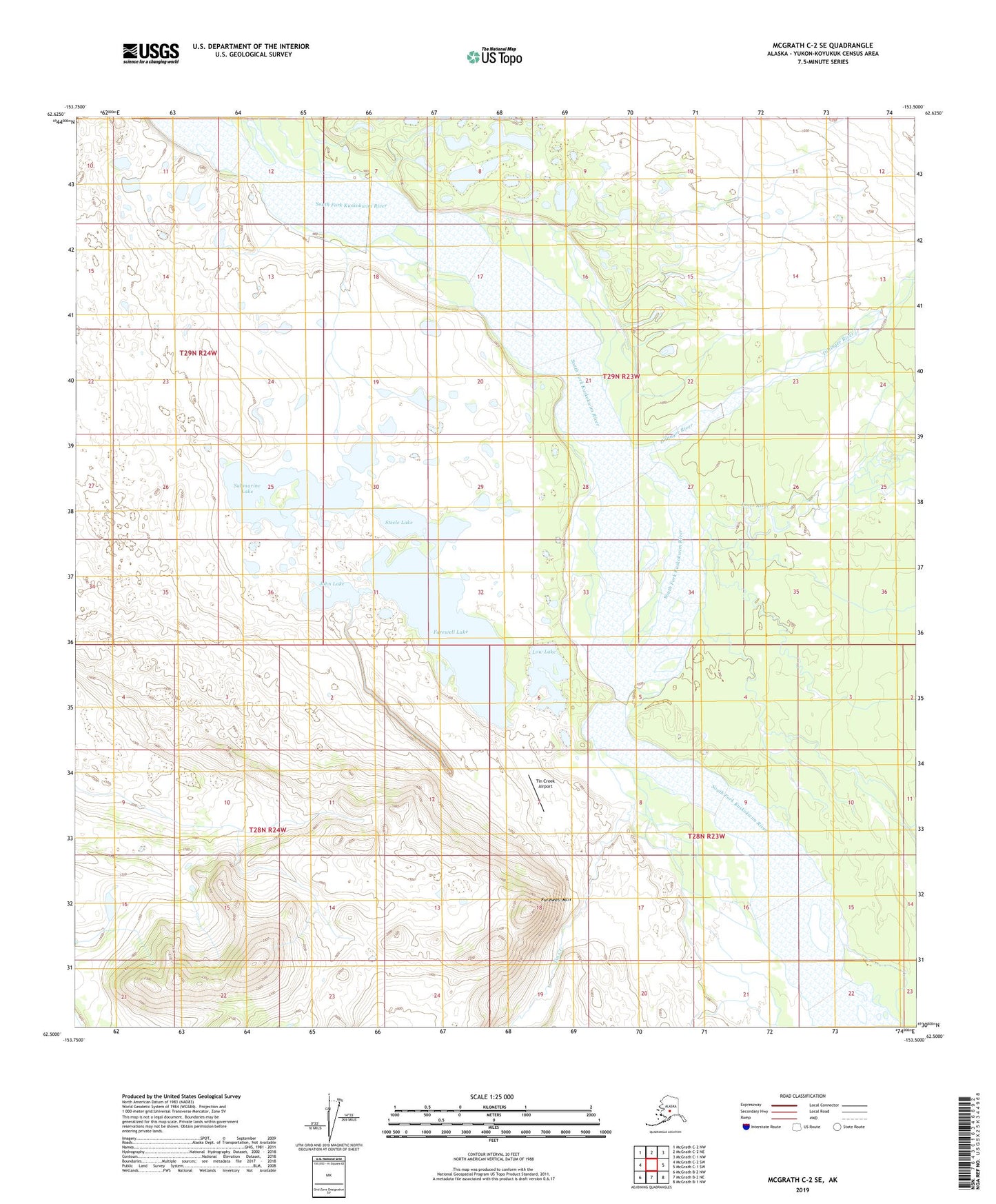
McGrath C-2 SE Alaska US Topo Map
Couldn't load pickup availability
2019 topographic map quadrangle McGrath C-2 SE in the state of Alaska. Scale: 1:25000. Print Size: 24" x 29"
Based on the newly updated USGS 7.5' US Topo series, this map has UTM / MGRS grids and is in the following counties: Yukon-Koyukuk (CA).
The map contains contour data, water features, and other items you are used to seeing on U.S. Geological Survey maps, but also has updated roads and other features. This is the next generation of topographic maps. Printed on high-quality waterproof paper with UV fade-resistant inks.
Contains the following named places: Dillinger River, Farewell Lake, Farewell Lake Lodge, Farewell Mountain, John Lake, Jones River, Low Lake, Steele Lake, Submarine Lake, Tin Creek, Tin Creek Airport, Farewell Lake Seaplane Base