MyTopo
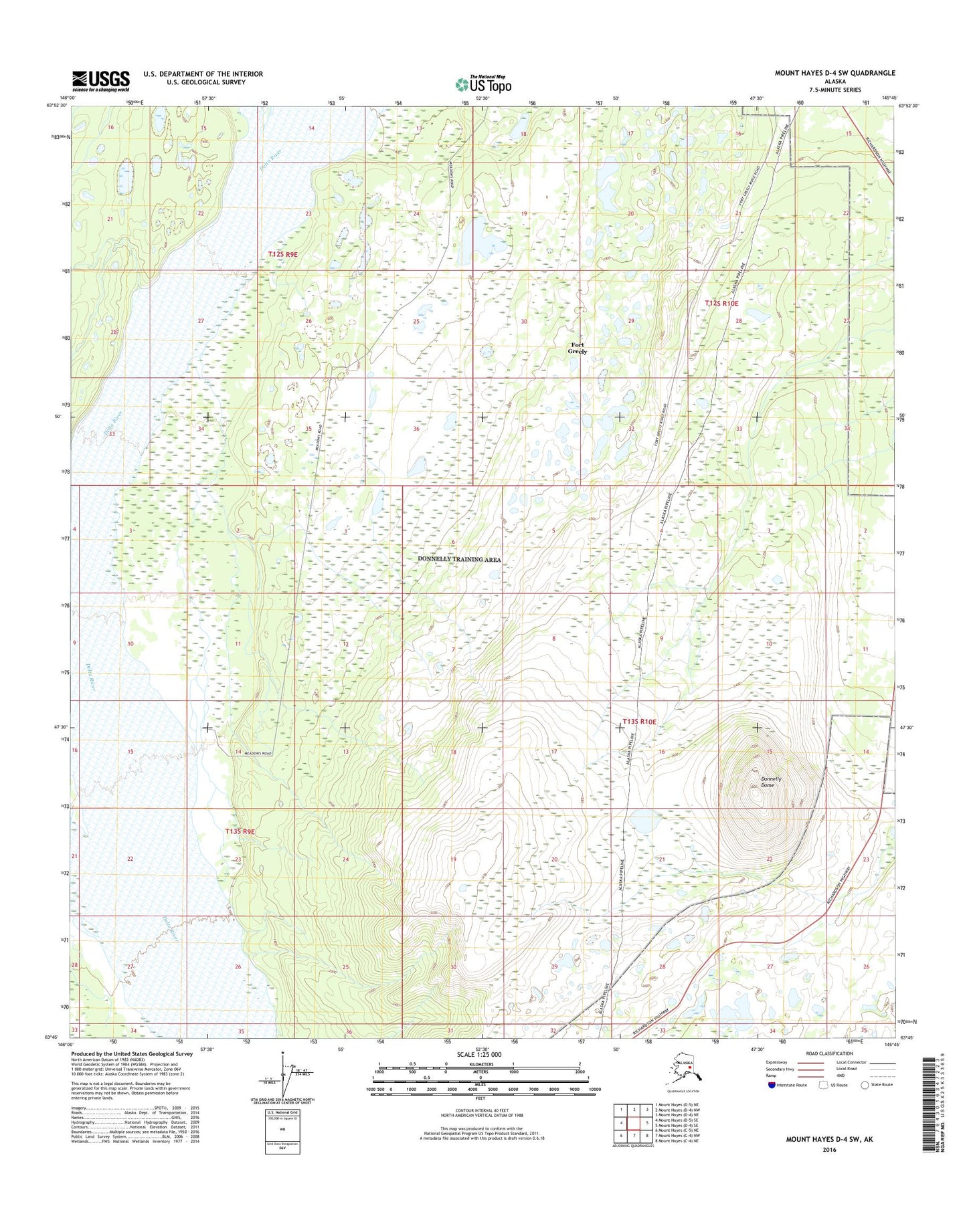
Mount Hayes D-4 SW Alaska US Topo Map
Couldn't load pickup availability
2016 topographic map quadrangle Mount Hayes D-4 SW in the state of Alaska. Scale: 1:25000. Print Size: 24" x 29"
Based on the newly updated USGS 7.5' US Topo series, this map has UTM / MGRS grids and is in the following counties: Southeast Fairbanks (CA).
The map contains contour data, water features, and other items you are used to seeing on U.S. Geological Survey maps, but also has updated roads and other features. This is the next generation of topographic maps. Printed on high-quality waterproof paper with UV fade-resistant inks.
Contains the following named places: Big Lake, Donnelly Dome, Chet Lake, Doc Lake, Donnelly Lake, Ghost Lake, J Lake, Mark Lake, Artillery Lake, Stryker Lake, Meadows Road Number 3 Lake, Meadows Road Number 4 Lake, Nickel Lake, No Mercy Lake, North Twin Lake, Rockhound Lake, South Twin Lake, Cavalry Lake