MyTopo
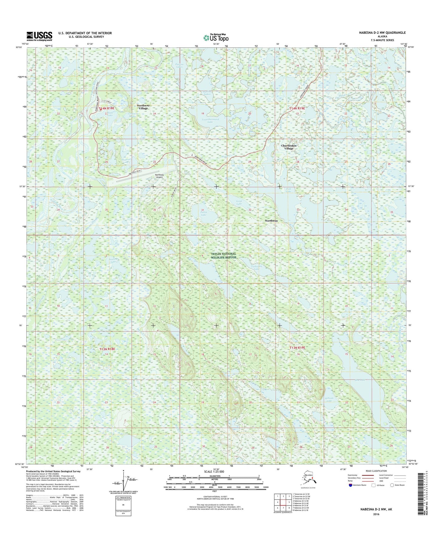
Nabesna D-2 NW Alaska US Topo Map
Couldn't load pickup availability
2016 topographic map quadrangle Nabesna D-2 NW in the state of Alaska. Scale: 1:25000. Print Size: 24" x 29"
Based on the newly updated USGS 7.5' US Topo series, this map has UTM / MGRS grids and is in the following counties: Southeast Fairbanks (CA).
The map contains contour data, water features, and other items you are used to seeing on U.S. Geological Survey maps, but also has updated roads and other features. This is the next generation of topographic maps. Printed on high-quality waterproof paper with UV fade-resistant inks.
Contains the following named places: Andrew Lake, Cemetery Lake, Charlieskin Creek, Charlieskin Village, Dog Lake, Fish Lake, Hillside Lake, Hudeuc Lake, Indian Cemetery, Kathakne Village, Mark Creek, Nabesna Slough, Nabesna Village, Northway, Northway Village, Open Creek, Pauline Lakes, Pullin Lake, Skate Lake, Tontethaimund Lake, Tushaday Lake, Northway Airport, Kathakne, Long Lake, Northway Alaska Native Village Statistical Area, Northway Village Census Designated Place (historical), Northway Village Fire Department, Tanana Chiefs Conference Northway Clinic, Northway First Responder Service, Northway Post Office