MyTopo
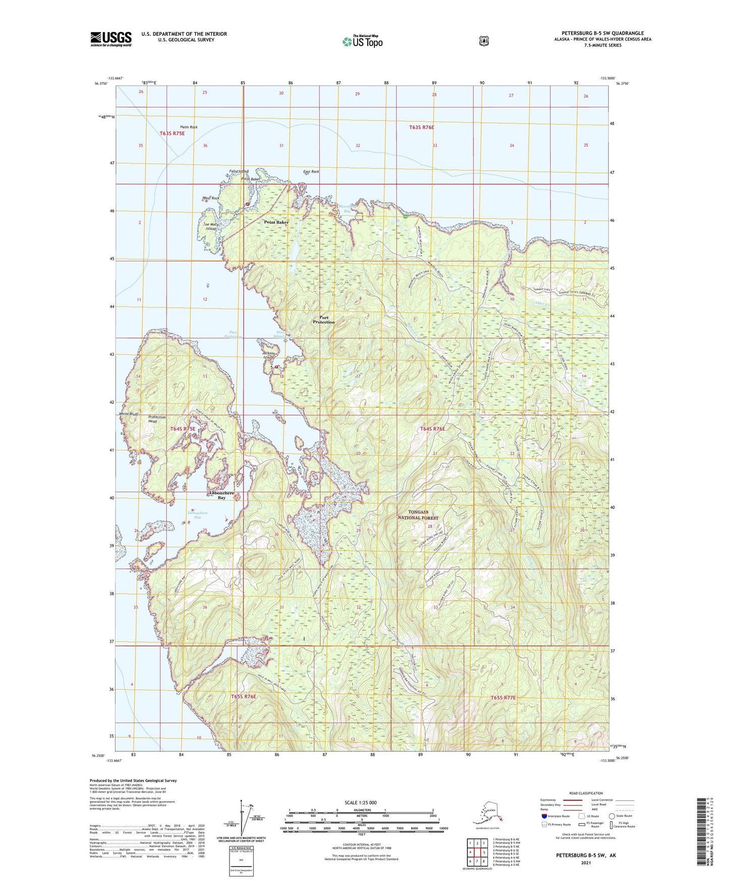
Petersburg B-5 SW Alaska US Topo Map
Couldn't load pickup availability
2021 topographic map quadrangle Petersburg B-5 SW in the state of Alaska. Scale: 1:25000. Print Size: 24" x 29"
Based on the newly updated USGS 7.5' US Topo series, this map has UTM / MGRS grids and is in the following counties: Prince of Wales-Hyder (CA), Petersburg Borough.
The map contains contour data, water features, and other items you are used to seeing on U.S. Geological Survey maps, but also has updated roads and other features. This is the next generation of topographic maps. Printed on high-quality waterproof paper with UV fade-resistant inks.
Contains the following named places: West Rock, Wooden Wheel Cove, Tuxkan Dam, Point Baker Seaplane Base, Port Protection Seaplane Base, East Rock, White Bluff, Alder Creek, Baker Creek, Flicker Creek, Helm Rock, Hole-in-the-wall, Joe Mace Island, Labouchere Bay, Merrifield Bay, Point Baker, Point Baker, Port Protection, Port Protection, Protection Head, Labouchere Bay, Port Protection, False Island, Point Baker Census Designated Place, Port Protection Census Designated Place, Point Baker Volunteer Fire Department, Port Protection Volunteer Fire Department, Alaska Island Community Services Port Protection Clinic, Alaska Island Community Services Point Baker Clinic, Joe Mace Island State Marine Park, Point Baker Post Office, Jackson Island