MyTopo
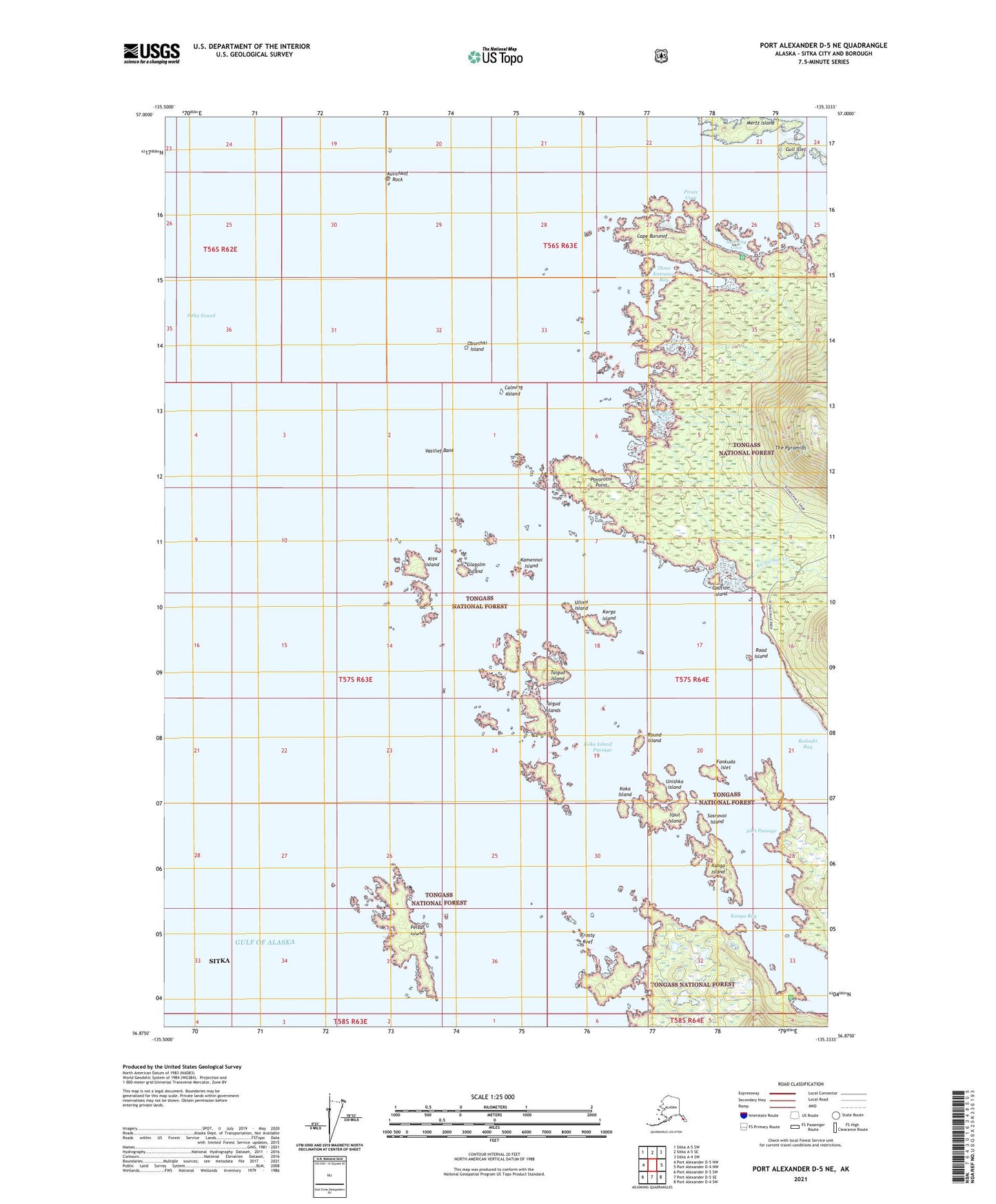
Port Alexander D-5 NE Alaska US Topo Map
Couldn't load pickup availability
2021 topographic map quadrangle Port Alexander D-5 NE in the state of Alaska. Scale: 1:25000. Print Size: 24" x 29"
Based on the newly updated USGS 7.5' US Topo series, this map has UTM / MGRS grids and is in the following counties: Sitka.
The map contains contour data, water features, and other items you are used to seeing on U.S. Geological Survey maps, but also has updated roads and other features. This is the next generation of topographic maps. Printed on high-quality waterproof paper with UV fade-resistant inks.
Contains the following named places: Samsing Cove, Sitka Sound, Sosnovoi Island, Taigud Island, Three Entrance Bay, Ulinoi Island, Unishka Island, Vasilief Bank, Taigud Islands, Koka Island Passage, Calming Island, Cape Burunof, Caution Island, Fankuda Islet, Frosty Reef, Glagolm Island, Gull Islet, Ilput Island, Islet Passage, Kamennoi Island, Kanga Bay, Kanga Island, Kita Island, Kizhuchia Creek, Koka Island, Korga Island, Kulichkof Rock, Long Island, Mielkoi Cove, Obsechki Island, Peisar Island, Pirate Cove, Povorotni Point, Redoubt Bay, Road Island, Round Island