MyTopo
Samalga Island D-3 NW Alaska US Topo Map
Couldn't load pickup availability
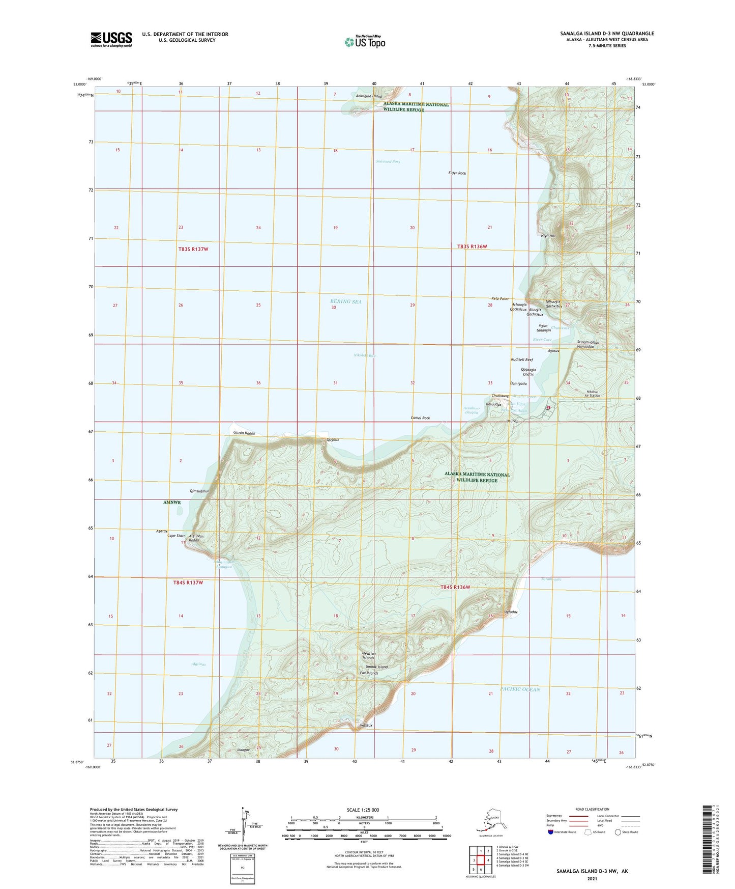
2021 topographic map quadrangle Samalga Island D-3 NW in the state of Alaska. Scale: 1:25000. Print Size: 24" x 29"
Based on the newly updated USGS 7.5' US Topo series, this map has UTM / MGRS grids and is in the following counties: Aleutians West (CA).
The map contains contour data, water features, and other items you are used to seeing on U.S. Geological Survey maps, but also has updated roads and other features. This is the next generation of topographic maps. Printed on high-quality waterproof paper with UV fade-resistant inks.
Contains the following named places: Camel Rock, Cape Starr, Eider Rock, High Hill, Kelp Point, Nikolski, Nikolski Bay, Sheep Creek, Umnak Lake, River Cove, Mueller Cove, Rudisell Reef, Isla Monterde, Nikolski Alaska Native Village Statistical Area, Chaluka Site, Achuugix Qachxitux, Aluugix Qachxitux, Qaluugix Qachxitux, Iigim-tanangin, Chunixsux, Stinam-qalan Iganaadaa, Agusux, Qagaagix Chatix, Damigasix, Axsxidax Adaa, Utunan, Ikan Udax, Iidluudax, Chulkaang, Asuulum-chuqaa, Waxtux, Ikaagux, Algiinax, Algiinam Anii, Qalmanagux, Sitminaakax, Saagmagim Agaaguu, Algiinam Kadaa, Agatax, Qimsugalux, Silusin Kadaa, Qugdux, Anim Aduu, Tatum-qala, Ugluudam Anii, Alim Anii, Ugludax, Anagulam Chmaa, Nikolski Volunteer Fire Department, Nikolski Air Station, Aleutian Pribilof Islands Association Nikolski Clinic, Nikolski Post Office