MyTopo
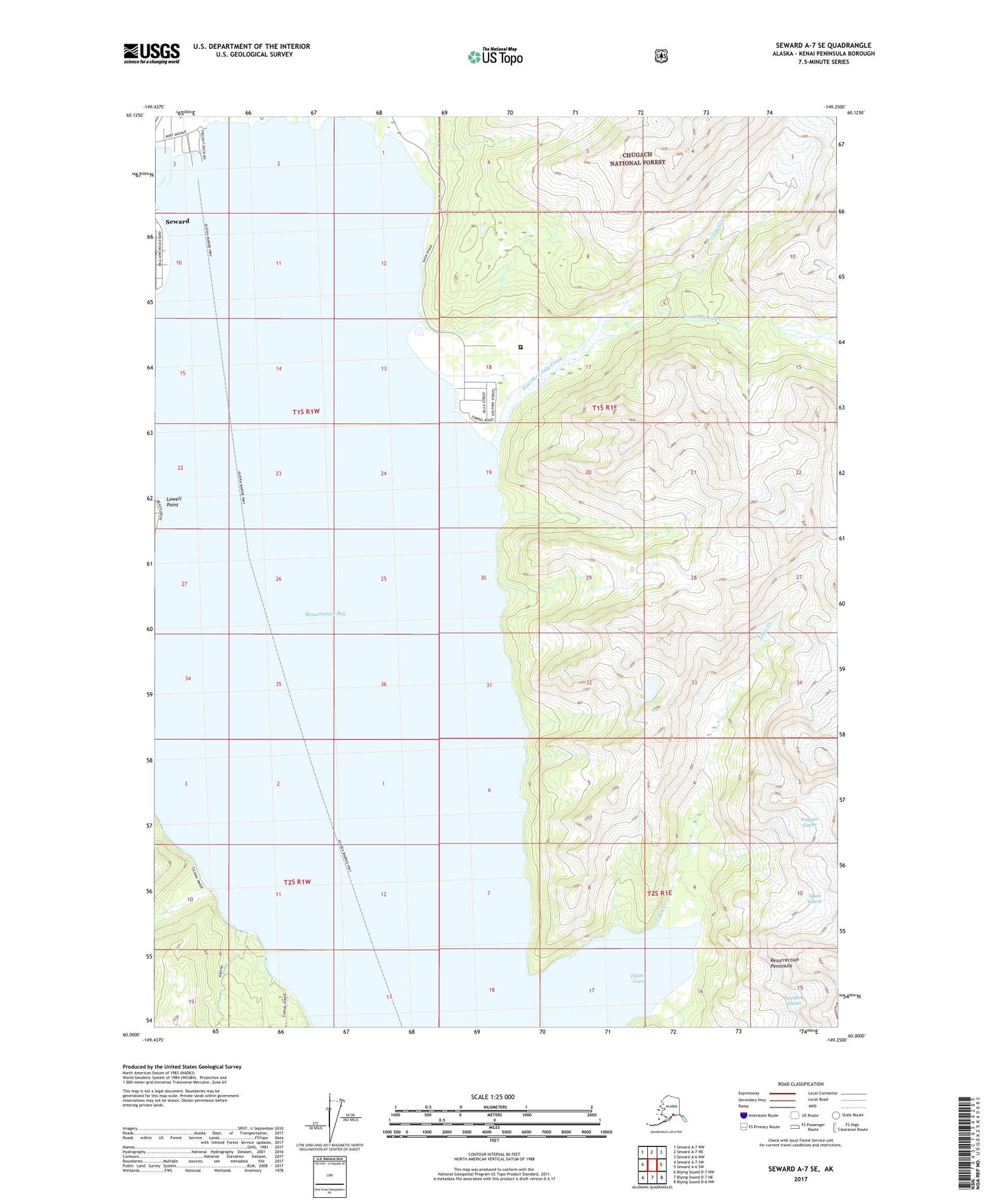
Seward A-7 SE Alaska US Topo Map
Couldn't load pickup availability
2017 topographic map quadrangle Seward A-7 SE in the state of Alaska. Scale: 1:25000. Print Size: 24" x 29"
Based on the newly updated USGS 7.5' US Topo series, this map has UTM / MGRS grids and is in the following counties: Kenai Peninsula.
The map contains contour data, water features, and other items you are used to seeing on U.S. Geological Survey maps, but also has updated roads and other features. This is the next generation of topographic maps. Printed on high-quality waterproof paper with UV fade-resistant inks.
Contains the following named places: Resurrection River, Spoon Glacier, Thumb Cove, KSRD-FM (Seward), Fourth of July Creek, Likes Creek, Lowell Point, Porcupine Glacier, Prospect Glacier, Spring Creek, Godwin Creek, City of Seward, Thumb Cove State Marine Park, Spring Creek Correctional Center