MyTopo
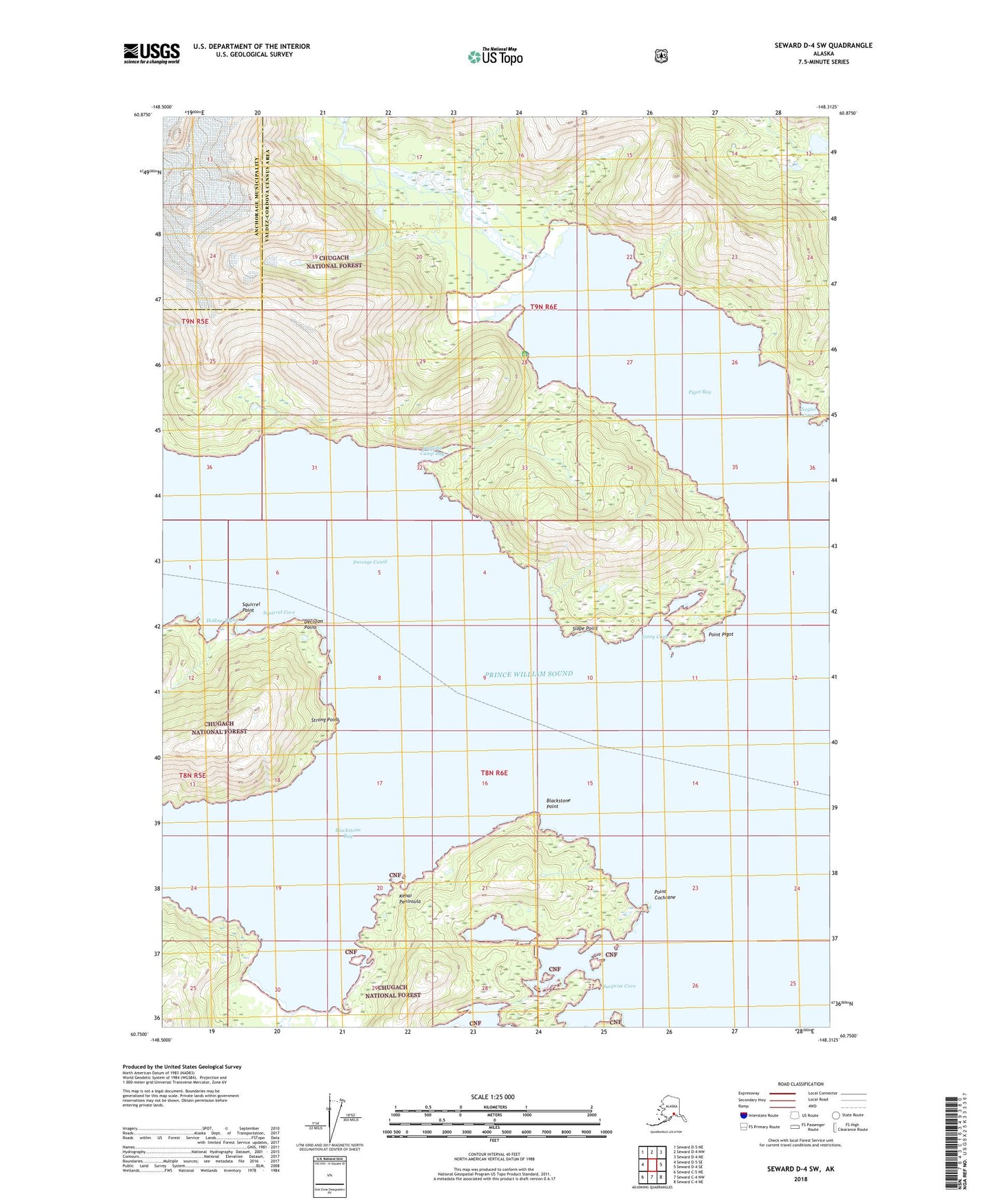
Seward D-4 SW Alaska US Topo Map
Couldn't load pickup availability
2018 topographic map quadrangle Seward D-4 SW in the state of Alaska. Scale: 1:25000. Print Size: 24" x 29"
Based on the newly updated USGS 7.5' US Topo series, this map has UTM / MGRS grids and is in the following counties: Valdez-Cordova (CA), Anchorage.
The map contains contour data, water features, and other items you are used to seeing on U.S. Geological Survey maps, but also has updated roads and other features. This is the next generation of topographic maps. Printed on high-quality waterproof paper with UV fade-resistant inks.
Contains the following named places: Slope Point, Squirrel Cove, Squirrel Point, Strong Point, Surprise Cove, Ziegler Cove, Blackstone Point, Decision Point, Entry Cove, Hollow Bight, Lansing Mine, Logging Camp Bay, Pigot Bay, Point Cochrane, Point Pigot, Point Pigot Light, Pigot Bay Cabin, Ziegler Cove State Marine Park, Entry Cove State Marine Park, Surprise Cove State Marine Park, Decision Point State Marine Park