MyTopo
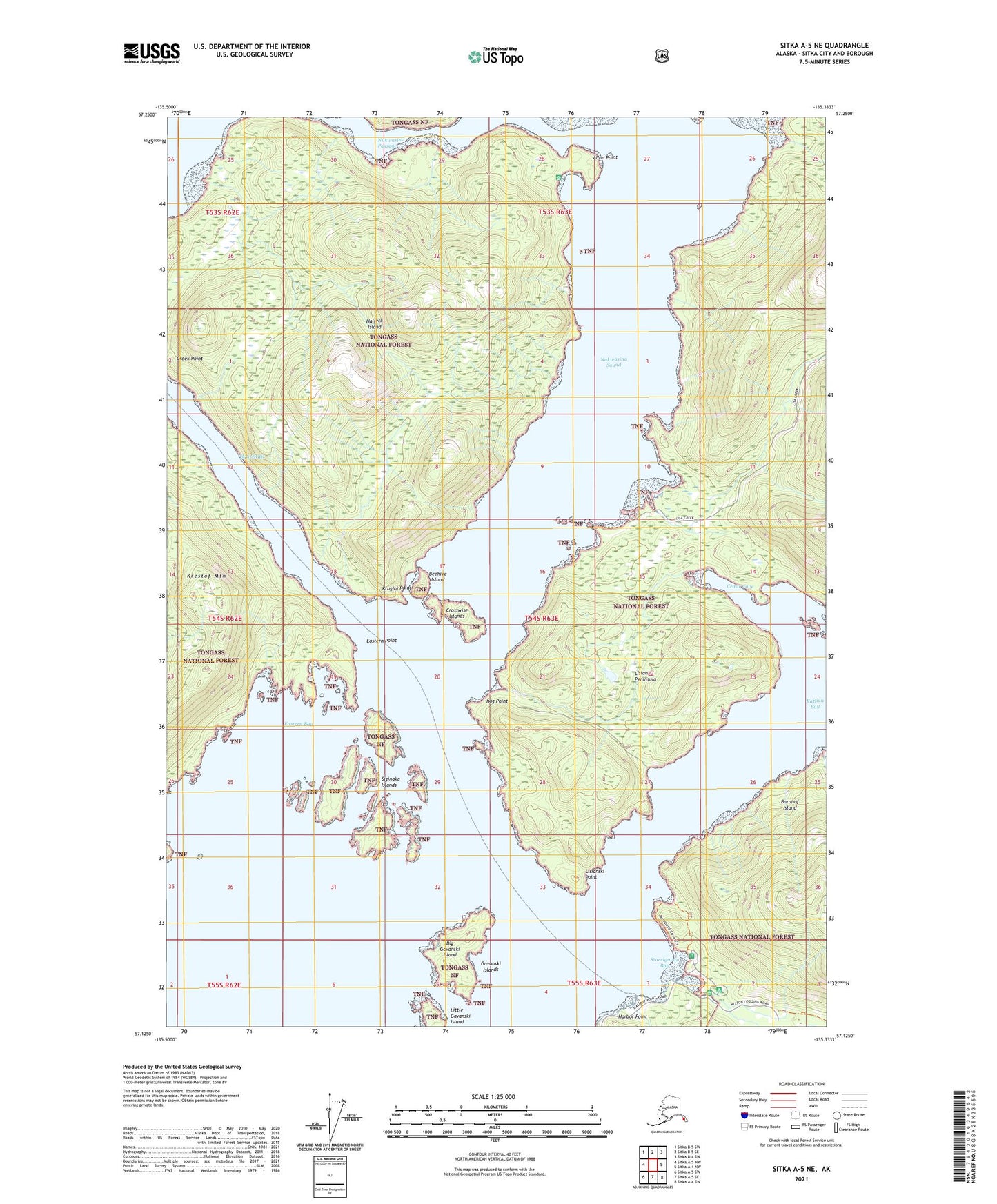
Sitka A-5 NE Alaska US Topo Map
Couldn't load pickup availability
2021 topographic map quadrangle Sitka A-5 NE in the state of Alaska. Scale: 1:25000. Print Size: 24" x 29"
Based on the newly updated USGS 7.5' US Topo series, this map has UTM / MGRS grids and is in the following counties: Sitka.
The map contains contour data, water features, and other items you are used to seeing on U.S. Geological Survey maps, but also has updated roads and other features. This is the next generation of topographic maps. Printed on high-quality waterproof paper with UV fade-resistant inks.
Contains the following named places: Lisianski Point, Starrigavan Bay, Starrigavan Campground, Siginaka Islands, Allan Point, Beehive Island, Big Gavanski Island, Cedar Cove, Crosswise Islands, Dog Point, Eastern Point, Halleck Island, Harbor Point, Katlian Bay, Krestof Mountain, Krugloi Point, Lisianski Peninsula, Little Gavanski Island, Nakwasina Passage, Nakwasina Sound, Olga Strait, Gavanski Islands, Eastern Bay