MyTopo
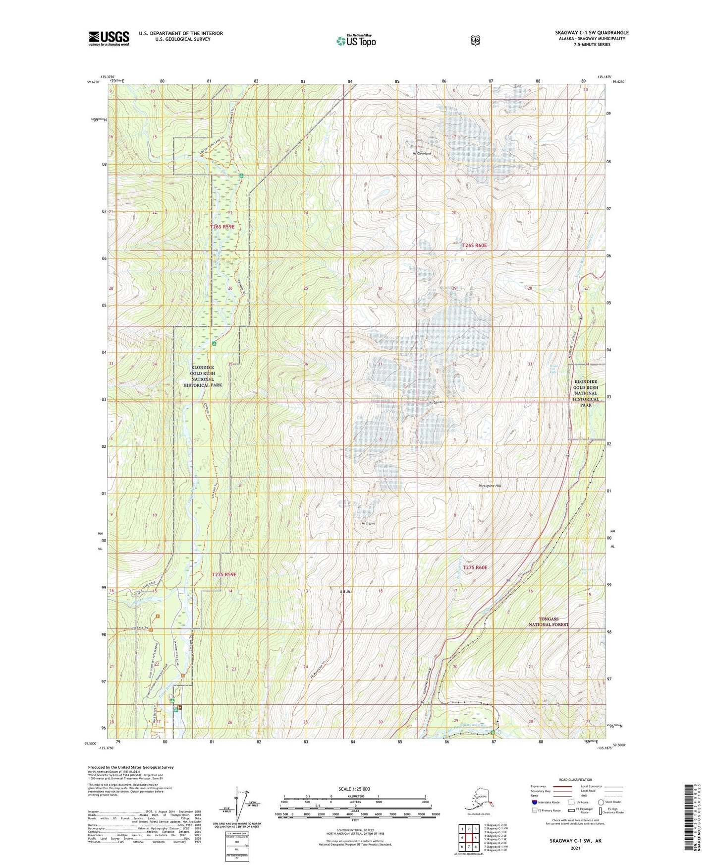
Skagway C-1 SW Alaska US Topo Map
Couldn't load pickup availability
2021 topographic map quadrangle Skagway C-1 SW in the state of Alaska. Scale: 1:25000. Print Size: 24" x 29"
Based on the newly updated USGS 7.5' US Topo series, this map has UTM / MGRS grids and is in the following counties: Skagway.
The map contains contour data, water features, and other items you are used to seeing on U.S. Geological Survey maps, but also has updated roads and other features. This is the next generation of topographic maps. Printed on high-quality waterproof paper with UV fade-resistant inks.
Contains the following named places: West Creek, Bridal Veil Falls, Captain William Moore Creek, A B Mountain, Mount Carmack, Mount Cleveland, Mount Clifford, Clifton, Dyea, East Fork Skagway River, Eight Mile Canyon Prospect, Finnegans Point, Hasfords Sawmill, Nourse River, Pitchfork Falls, Porcupine Hill, Hosfords Sawmill, Finnegans Point, Skagway Census Subarea, Porcupine Creek, Skyline Trail, Black Lake, Skagway Municipality, Canyon City (historical), Skagway Alaska Native Village Statistical Area, Denver (historical), Rocky Point (historical), United States Customs and Border Protection Port of Entry Skagway