
MyTopo
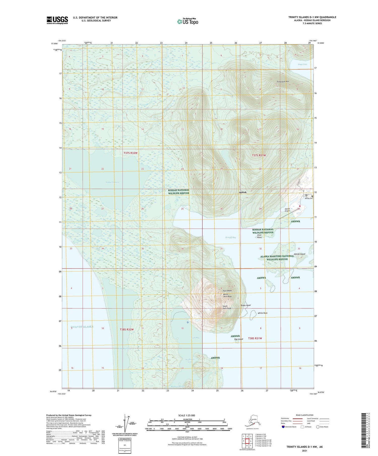
Trinity Islands D-1 NW Alaska US Topo Map
Couldn't load pickup availability
2021 topographic map quadrangle Trinity Islands D-1 NW in the state of Alaska. Scale: 1:25000. Print Size: 24" x 29"
Based on the newly updated USGS 7.5' US Topo series, this map has UTM / MGRS grids and is in the following counties: Kodiak Island.
The map contains contour data, water features, and other items you are used to seeing on U.S. Geological Survey maps, but also has updated roads and other features. This is the next generation of topographic maps. Printed on high-quality waterproof paper with UV fade-resistant inks.
Contains the following named places: Sukhoi Lagoon, Akhiok, Akhiok Island, Alitak Lagoon, Drake Head, Egg Island, Kempff Bay, Lazy Bay, North Twin Peak, Prior Point, Rodman Reach, Snug Cove, South Twin Peak, Tungulara Mountain, Twin Peaks, White Rock, Alitak Cannery Dam Number 3, Alitak Cannery Dam Number 2, Alitak Cannery Dam Number 1, Alitak Cannery Dam Number 4, Akhoik Dam, Akhiok Airport, Alitak Seaplane Base, Seaflower Cove, Sukhoi Lagoon, Akhiok Alaska Native Village Statistical Area, City of Akhiok, Kodiak Area Native Association Akhiok Health Clinic, Akhiok Village Response Team, Akhiok Post Office, Kaguyak Tribal Council Office, Akhiok Cemetery


