MyTopo
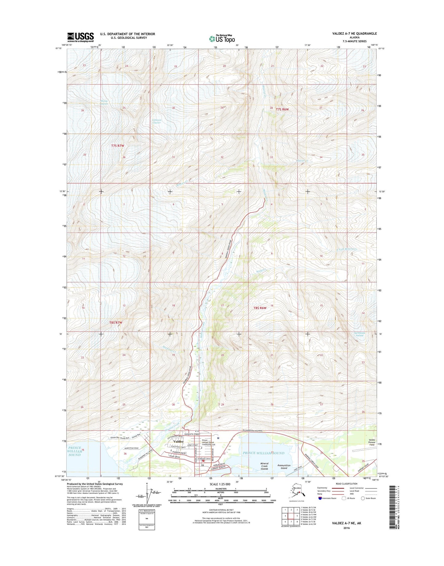
Valdez A-7 NE Alaska US Topo Map
Couldn't load pickup availability
2016 topographic map quadrangle Valdez A-7 NE in the state of Alaska. Scale: 1:25000. Print Size: 24" x 29"
Based on the newly updated USGS 7.5' US Topo series, this map has UTM / MGRS grids and is in the following counties: Valdez-Cordova (CA).
The map contains contour data, water features, and other items you are used to seeing on U.S. Geological Survey maps, but also has updated roads and other features. This is the next generation of topographic maps. Printed on high-quality waterproof paper with UV fade-resistant inks.
Contains the following named places: Big Four Mine, Brevier Creek, Cash Mine, East Fork Mineral Creek, Giant Mine, Glacier Creek, Hercules Mine, Horsetail Creek, Johnson Glacier, Johnson Mine, McIntosh, Mineral Creek, Mineral Creek Islands, Shoup Glacier, Smith Mill, Wood Creek, Valdez, Ammunition Island, Johnson Mill, Valdez Fire Department Station 1, CVTC Heliport, CVTC Heliport, Valdez Hospital Heliport, Valdez Hospital Heliport, Providence Valdez Medical Center, Valdez Public Health Center - South Central Region, Chugachmiut Tribal Organization Valdez Native Tribe Clinic, Valdez City Police Department, Alaska State Troopers Valdez, United States Customs and Border Protection Port of Entry Valdez, Valdez Post Office