
MyTopo
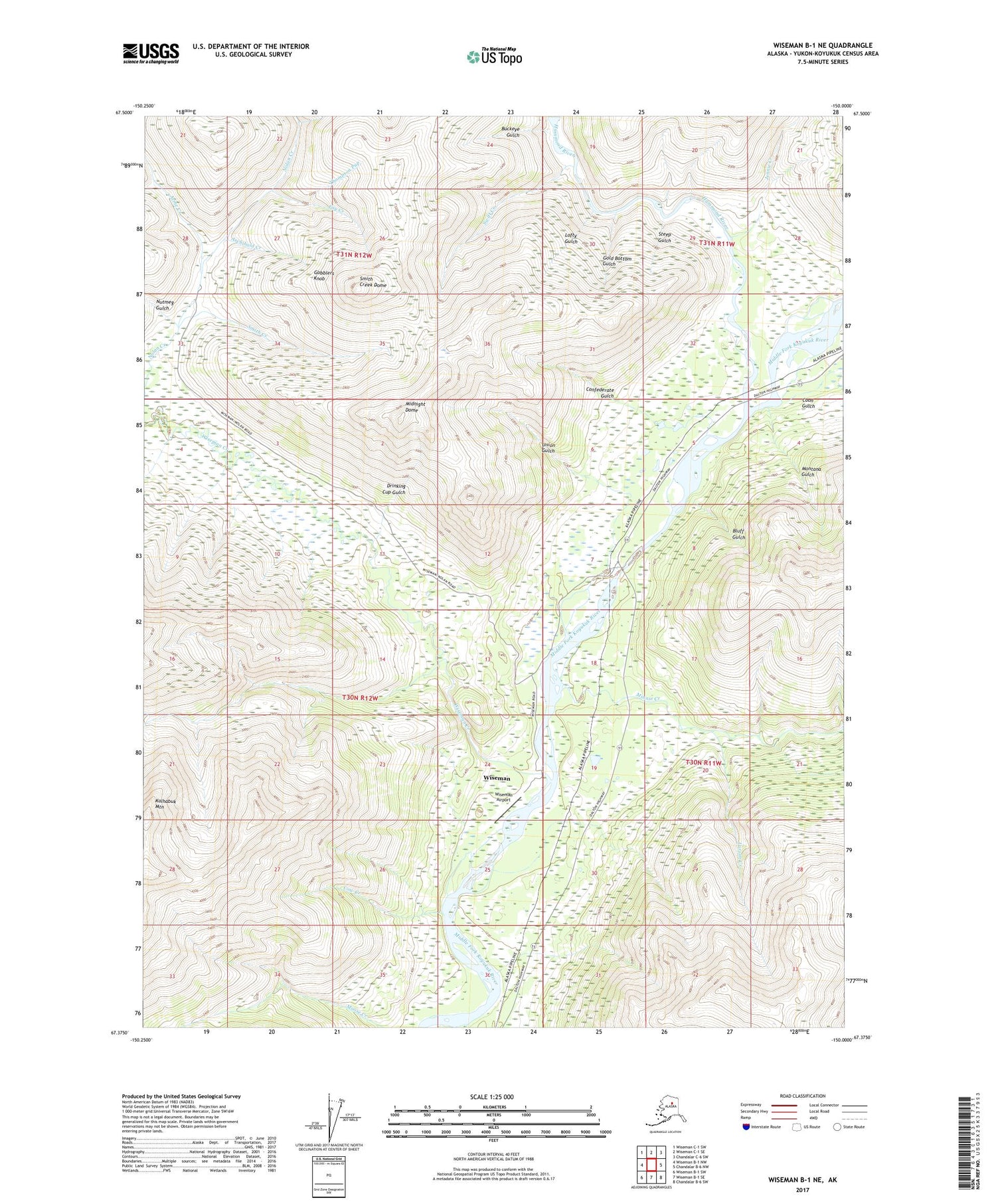
Wiseman B-1 NE Alaska US Topo Map
Couldn't load pickup availability
2017 topographic map quadrangle Wiseman B-1 NE in the state of Alaska. Scale: 1:25000. Print Size: 24" x 29"
Based on the newly updated USGS 7.5' US Topo series, this map has UTM / MGRS grids and is in the following counties: Yukon-Koyukuk (CA).
The map contains contour data, water features, and other items you are used to seeing on U.S. Geological Survey maps, but also has updated roads and other features. This is the next generation of topographic maps. Printed on high-quality waterproof paper with UV fade-resistant inks.
Contains the following named places: Archibald Creek, Bluff Gulch, Buckeye Gulch, Confederate Gulch, Cow Creek, Drinking Cup Gulch, Fay Creek, Gobblers Knob, Gold Bottom Gulch, Larson Creek, Lofty Gulch, Midnight Dome, Montana Gulch, Nolan, Nutmeg Gulch, Smith Creek, Smith Creek Dome, Steep Gulch, Swift Creek, Thompson Pup, Union Gulch, Wiseman, Wiseman Creek, Kalhabuk Mountain, Wiseman Airport, Acme Creek, Coon Gulch, Hammond River, Jennie Creek, Minnie Creek, Japanese Creek, Wiseman Census Designated Place


