MyTopo
Agua Caliente Arizona US Topo Map
Couldn't load pickup availability
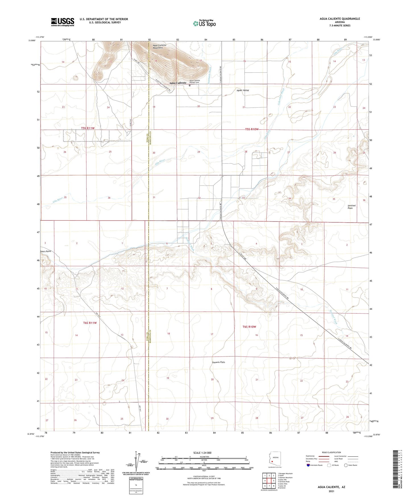
2021 topographic map quadrangle Agua Caliente in the state of Arizona. Scale: 1:24000. Based on the newly updated USGS 7.5' US Topo map series, this map is in the following counties: Maricopa, Yuma. The map contains contour data, water features, and other items you are used to seeing on USGS maps, but also has updated roads and other features. This is the next generation of topographic maps. Printed on high-quality waterproof paper with UV fade-resistant inks.
Quads adjacent to this one:
West: Aztec NW
Northwest: Baragan Mountain
North: Hyder
Northeast: Oatman Mountain
East: Sentinel Peak
Southeast: Sentinel
South: Aztec SE
Southwest: Aztec Hills
This map covers the same area as the classic USGS quad with code o32113h3.
Contains the following named places: Agua Caliente, Agua Caliente Pioneer Cemetery, Alpha, Browns Well, Columbus Wash, Copper Wash, Hyder Valley, Layton Well, Nottbusch Wash, San Bernardino, Sentinel Plain, Sentinel Wash, South Gila Ditch