MyTopo
Aguila Arizona US Topo Map
Couldn't load pickup availability
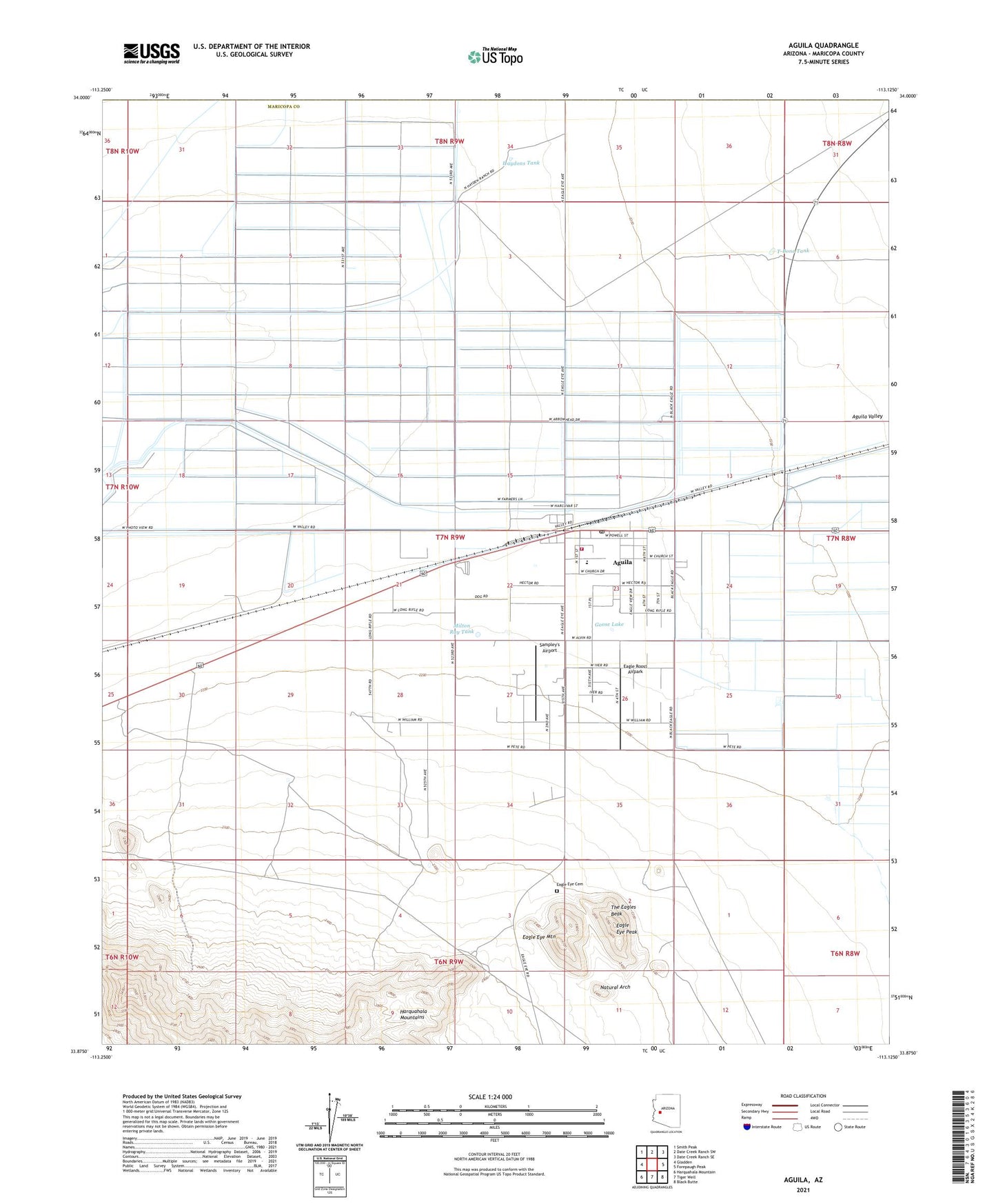
2021 topographic map quadrangle Aguila in the state of Arizona. Scale: 1:24000. Based on the newly updated USGS 7.5' US Topo map series, this map is in the following counties: Maricopa, Yavapai. The map contains contour data, water features, and other items you are used to seeing on USGS maps, but also has updated roads and other features. This is the next generation of topographic maps. Printed on high-quality waterproof paper with UV fade-resistant inks.
Quads adjacent to this one:
West: Gladden
Northwest: Smith Peak
North: Date Creek Ranch SW
Northeast: Date Creek Ranch SE
East: Forepaugh Peak
Southeast: Black Butte
South: Tiger Well
Southwest: Harquahala Mountain
This map covers the same area as the classic USGS quad with code o33113h2.
Contains the following named places: Aguila, Aguila Census Designated Place, Aguila Elementary School, Aguila Post Office, Aguila Railroad Station, Aguila Substation, Aguila Volunteer Fire Department, Eagle Eye Cemetery, Eagle Eye Mountain, Eagle Eye Peak, Eagle Eye Ranch, Eagle Roost Airpark, Goose Lake, Grass Wash, Haydons Tank, Hillair Dirt Strip Airport, Hultman Well, Lapham Tank, Maricopa County Library District Aguila Branch, Milton Ray Tank, Natural Arch, Sampley's Airport, T-Bone Tank, The Eagles Beak, Tom Walder Memorial Park, ZIP Code: 85320