MyTopo
Bisbee NE Arizona US Topo Map
Couldn't load pickup availability
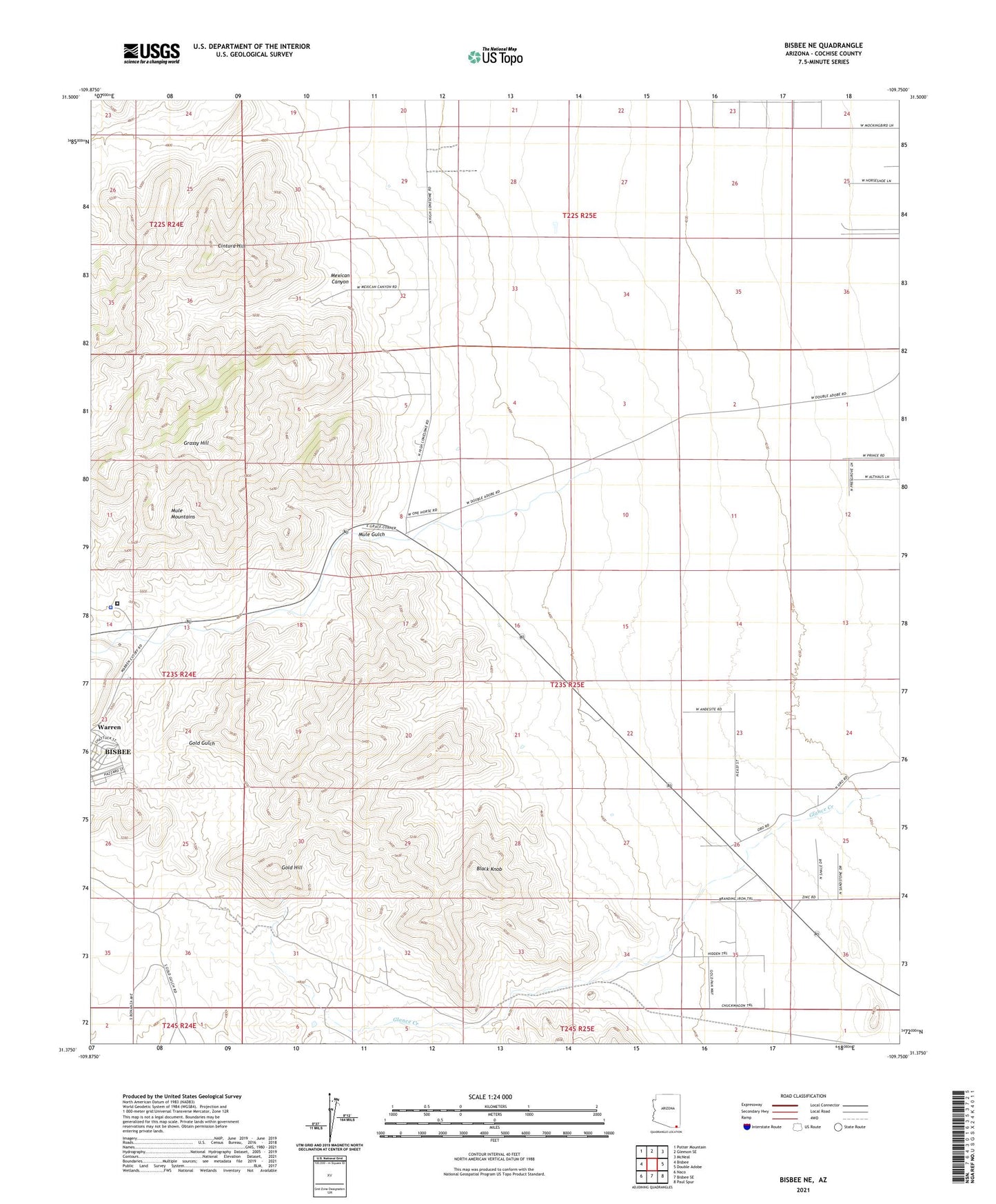
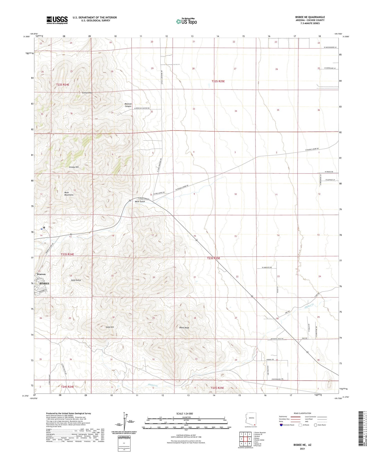
2021 topographic map quadrangle Bisbee NE in the state of Arizona. Scale: 1:24000. Based on the newly updated USGS 7.5' US Topo map series, this map is in the following counties: Cochise. The map contains contour data, water features, and other items you are used to seeing on USGS maps, but also has updated roads and other features. This is the next generation of topographic maps. Printed on high-quality waterproof paper with UV fade-resistant inks.
Quads adjacent to this one:
West: Bisbee
Northwest: Potter Mountain
North: Gleeson SE
Northeast: McNeal
East: Double Adobe
Southeast: Paul Spur
South: Bisbee SE
Southwest: Naco
This map covers the same area as the classic USGS quad with code o31109d7.
Contains the following named places: Black Knob, Cintura Hill, Cochise County Jail, Cochise County Sheriff's Office Bisbee Patrol District, Easter Sunday Mine, Forrest Ranch, Glance Creek, Gold Hill, Grassy Hill, Ivanhoe Mine, Korp Canyon, Mexican Canyon, Mule Gulch, Mule Mountains, Superior Mine