MyTopo
Butterfield Pass Arizona US Topo Map
Couldn't load pickup availability
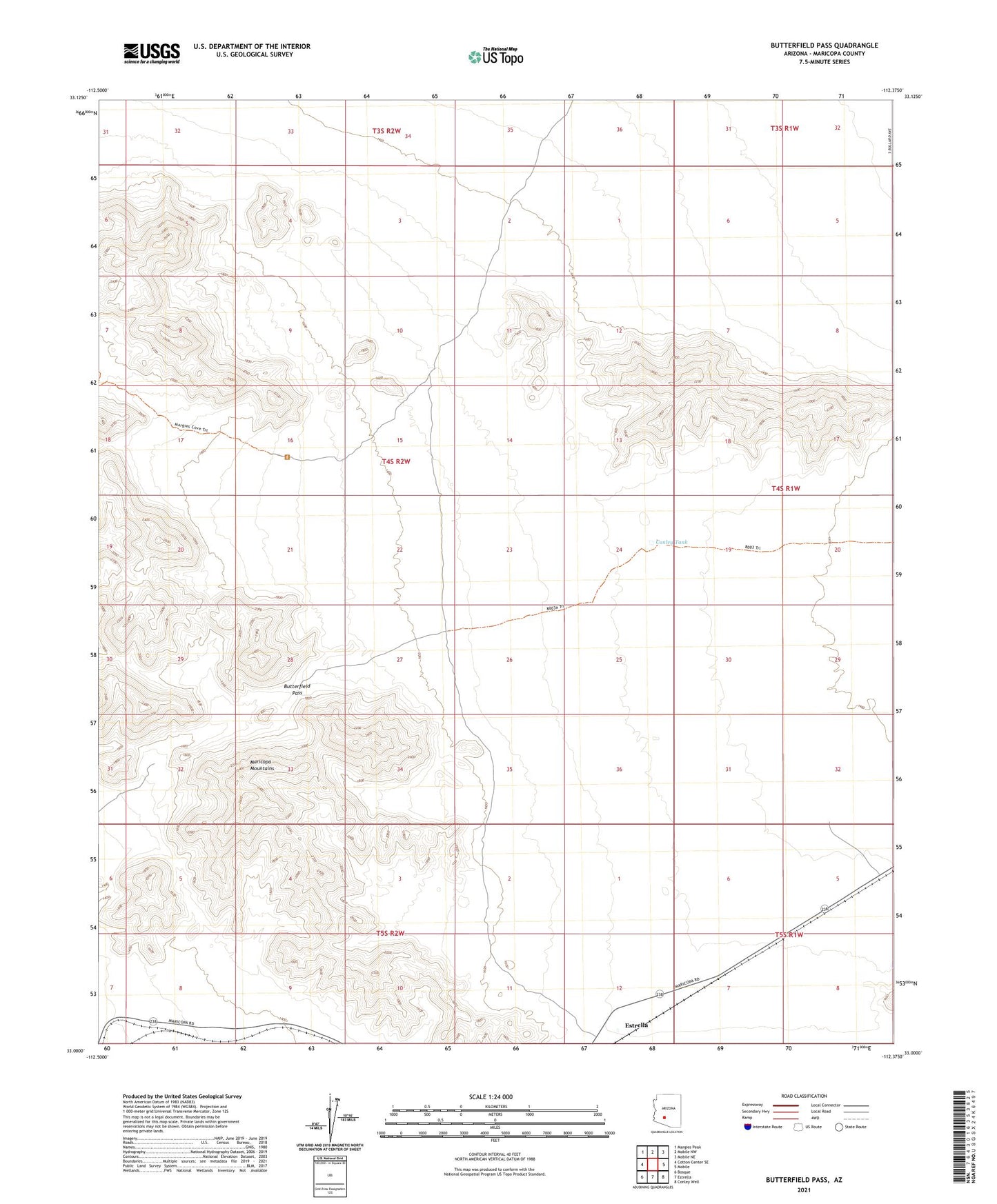
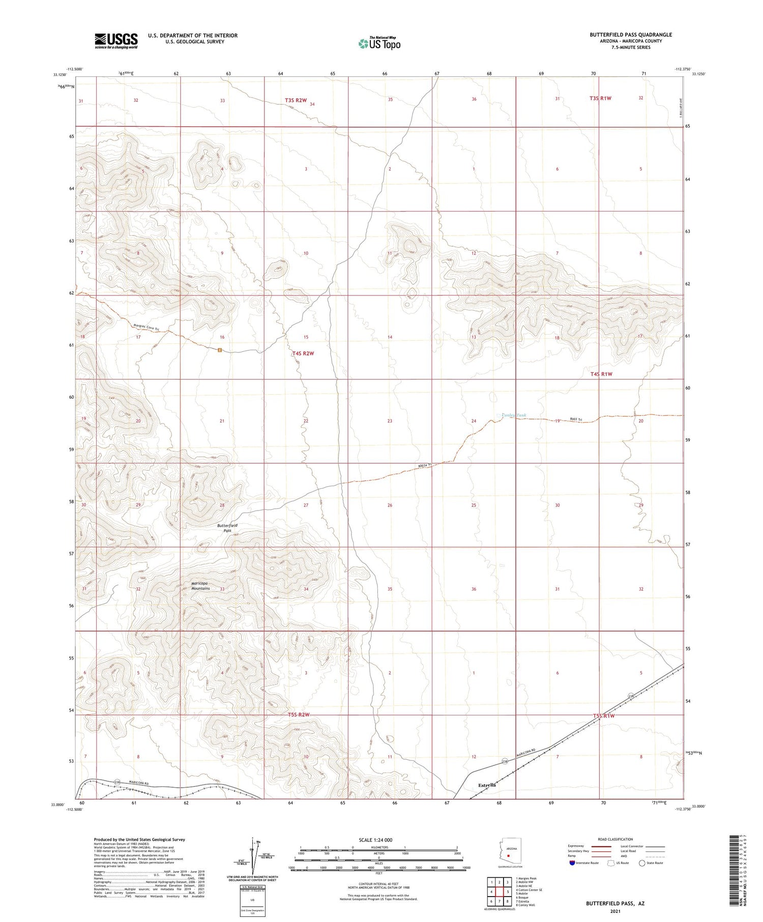
2021 topographic map quadrangle Butterfield Pass in the state of Arizona. Scale: 1:24000. Based on the newly updated USGS 7.5' US Topo map series, this map is in the following counties: Maricopa. The map contains contour data, water features, and other items you are used to seeing on USGS maps, but also has updated roads and other features. This is the next generation of topographic maps. Printed on high-quality waterproof paper with UV fade-resistant inks.
Quads adjacent to this one:
West: Cotton Center SE
Northwest: Margies Peak
North: Mobile NW
Northeast: Mobile NE
East: Mobile
Southeast: Conley Well
South: Estrella
Southwest: Bosque
This map covers the same area as the classic USGS quad with code o33112a4.
Contains the following named places: Butterfield Pass, Butterfield Trail Campsite, Conley Tank, Desert Station, Estrella, Estrella Railroad Station