MyTopo
Cerbat Arizona US Topo Map
Couldn't load pickup availability
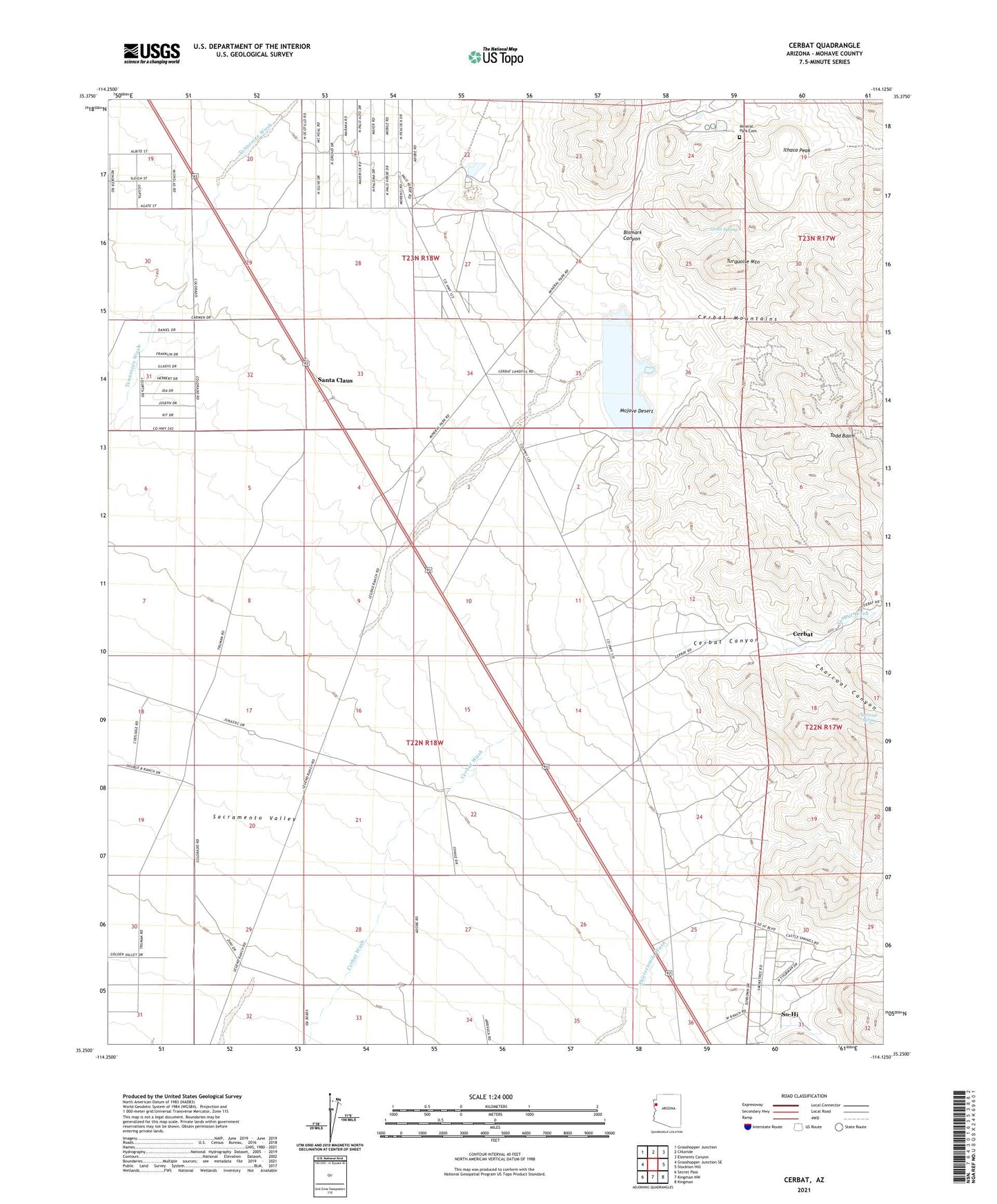
2021 topographic map quadrangle Cerbat in the state of Arizona. Scale: 1:24000. Based on the newly updated USGS 7.5' US Topo map series, this map is in the following counties: Mohave. The map contains contour data, water features, and other items you are used to seeing on USGS maps, but also has updated roads and other features. This is the next generation of topographic maps. Printed on high-quality waterproof paper with UV fade-resistant inks.
Quads adjacent to this one:
West: Grasshopper Junction SE
Northwest: Grasshopper Junction
North: Chloride
Northeast: Elements Canyon
East: Stockton Hill
Southeast: Kingman
South: Kingman NW
Southwest: Secret Pass
This map covers the same area as the classic USGS quad with code o35114c2.
Contains the following named places: Big Boy Mine, Bismark Canyon, Cashier Mine, Cerbat, Cerbat Canyon, Cerbat Mine, Champion Mine, Charcoal Canyon, Charcoal Spring, Emerald Isle Mine, Golconda Mine, Golden Gem Mine, Gross Spring, Idaho Mine, Ithaca Peak, Jamison Mine, Mineral Park, Mineral Park Cemetery, Mint Mine, Mohawk Mine, New London Mine, O'Brien Mine, Paymaster Mine, Santa Claus, So-Hi Census Designated Place, Todd Basin, Turquoise Mountain, Twins Mine, White Elephant Mine, Wildhorse Mine