MyTopo
Coyote Water Arizona US Topo Map
Couldn't load pickup availability
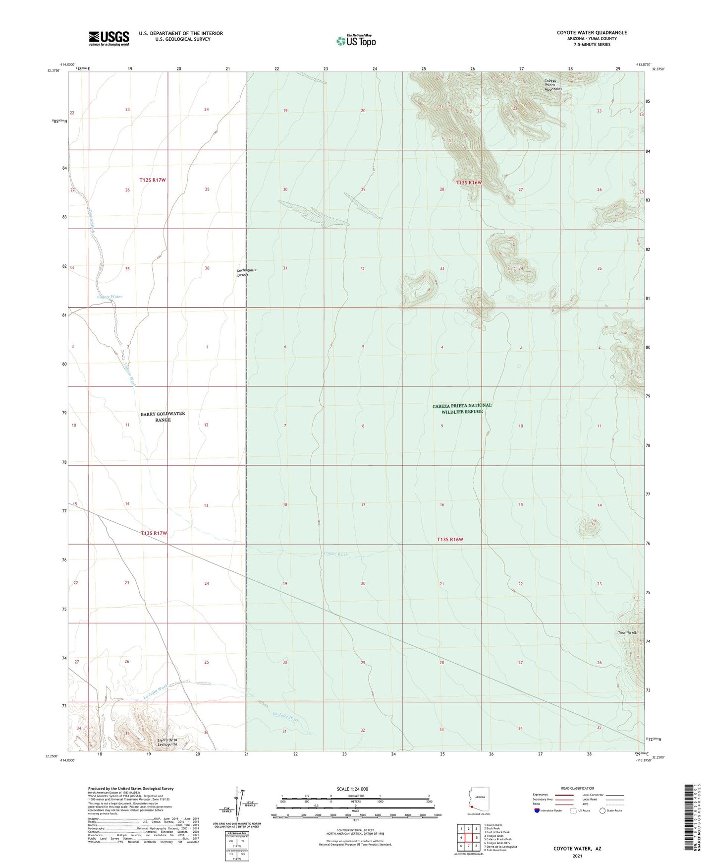
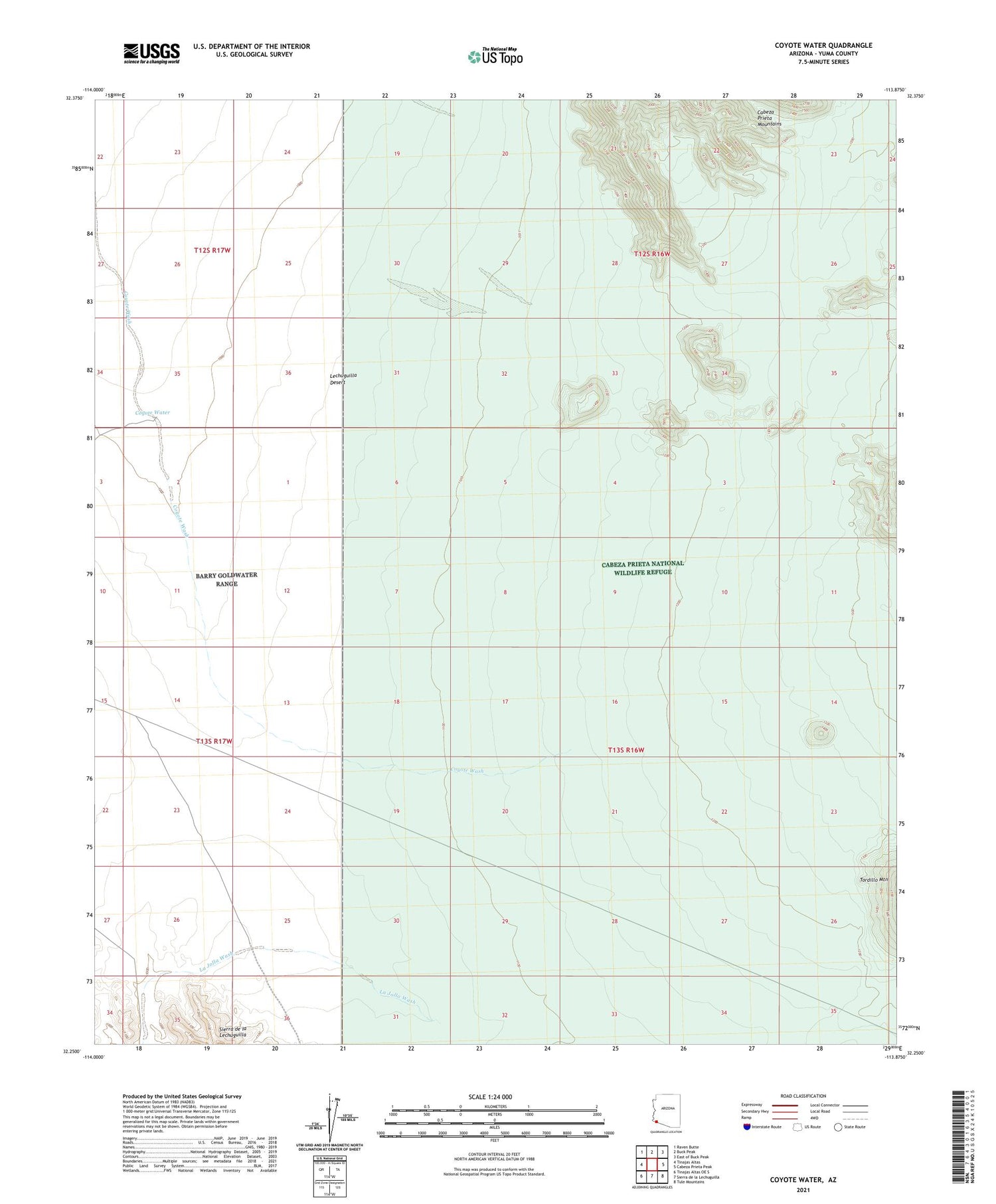
2021 topographic map quadrangle Coyote Water in the state of Arizona. Scale: 1:24000. Based on the newly updated USGS 7.5' US Topo map series, this map is in the following counties: Yuma. The map contains contour data, water features, and other items you are used to seeing on USGS maps, but also has updated roads and other features. This is the next generation of topographic maps. Printed on high-quality waterproof paper with UV fade-resistant inks.
Quads adjacent to this one:
West: Tinajas Altas
Northwest: Raven Butte
North: Buck Peak
Northeast: East of Buck Peak
East: Cabeza Prieta Peak
Southeast: Tule Mountains
South: Sierra de la Lechuguilla
Southwest: Tinajas Altas OE S
This map covers the same area as the classic USGS quad with code o32113c8.
Contains the following named places: Coyote Water