MyTopo
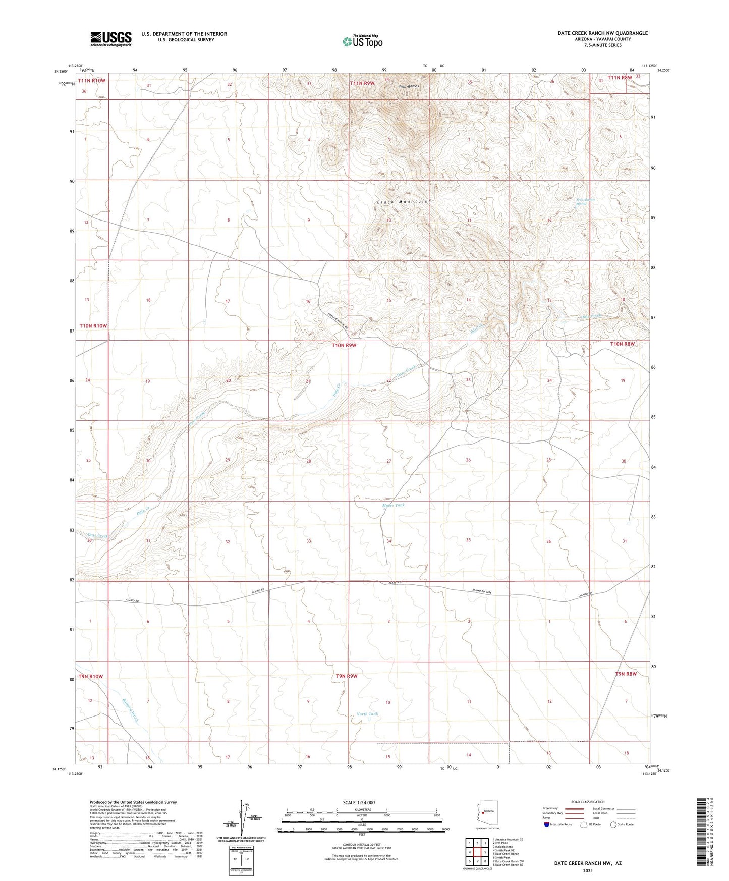
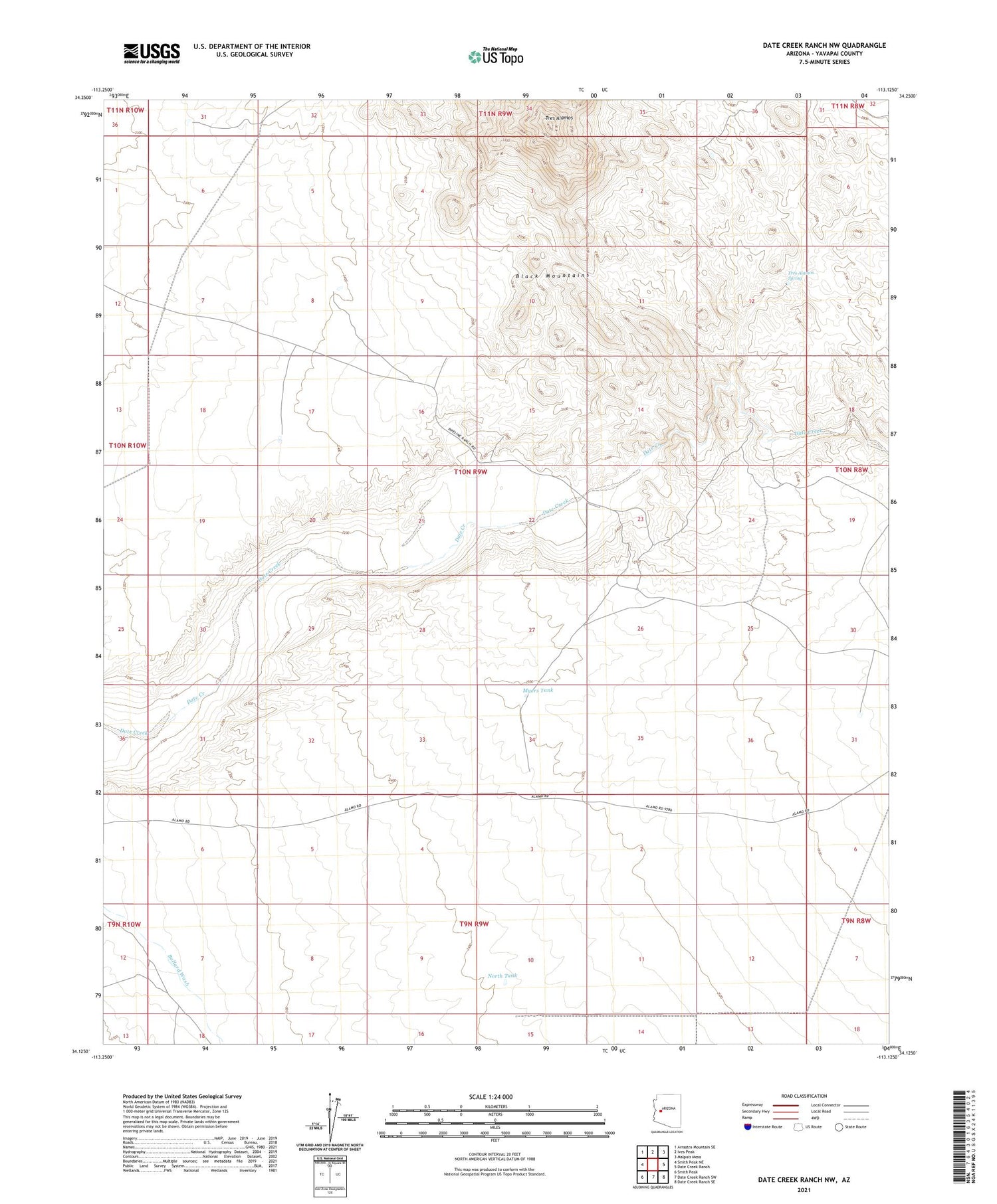
Date Creek Ranch NW Arizona US Topo Map
Couldn't load pickup availability
2021 topographic map quadrangle Date Creek Ranch NW in the state of Arizona. Scale: 1:24000. Based on the newly updated USGS 7.5' US Topo map series, this map is in the following counties: Yavapai. The map contains contour data, water features, and other items you are used to seeing on USGS maps, but also has updated roads and other features. This is the next generation of topographic maps. Printed on high-quality waterproof paper with UV fade-resistant inks.
Quads adjacent to this one:
West: Smith Peak NE
Northwest: Arrastra Mountain SE
North: Ives Peak
Northeast: Malpais Mesa
East: Date Creek Ranch
Southeast: Date Creek Ranch SE
South: Date Creek Ranch SW
Southwest: Smith Peak
This map covers the same area as the classic USGS quad with code o34113b2.
Contains the following named places: Black Mountains, Myers Tank, North Tank, Tres Alamos, Tres Alamos Spring, Tres Alamos Wilderness