MyTopo
Dateland Arizona US Topo Map
Couldn't load pickup availability
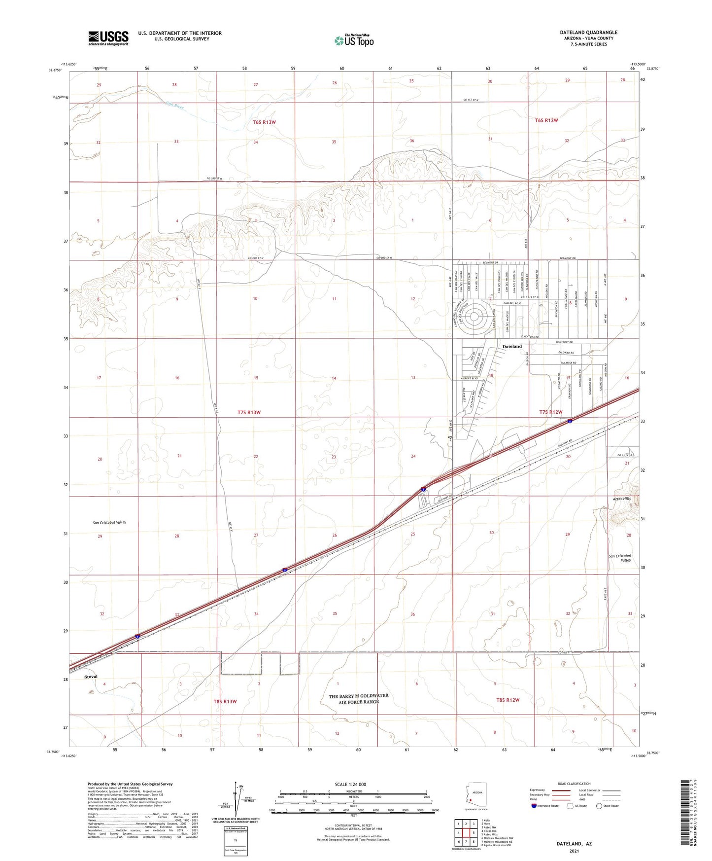
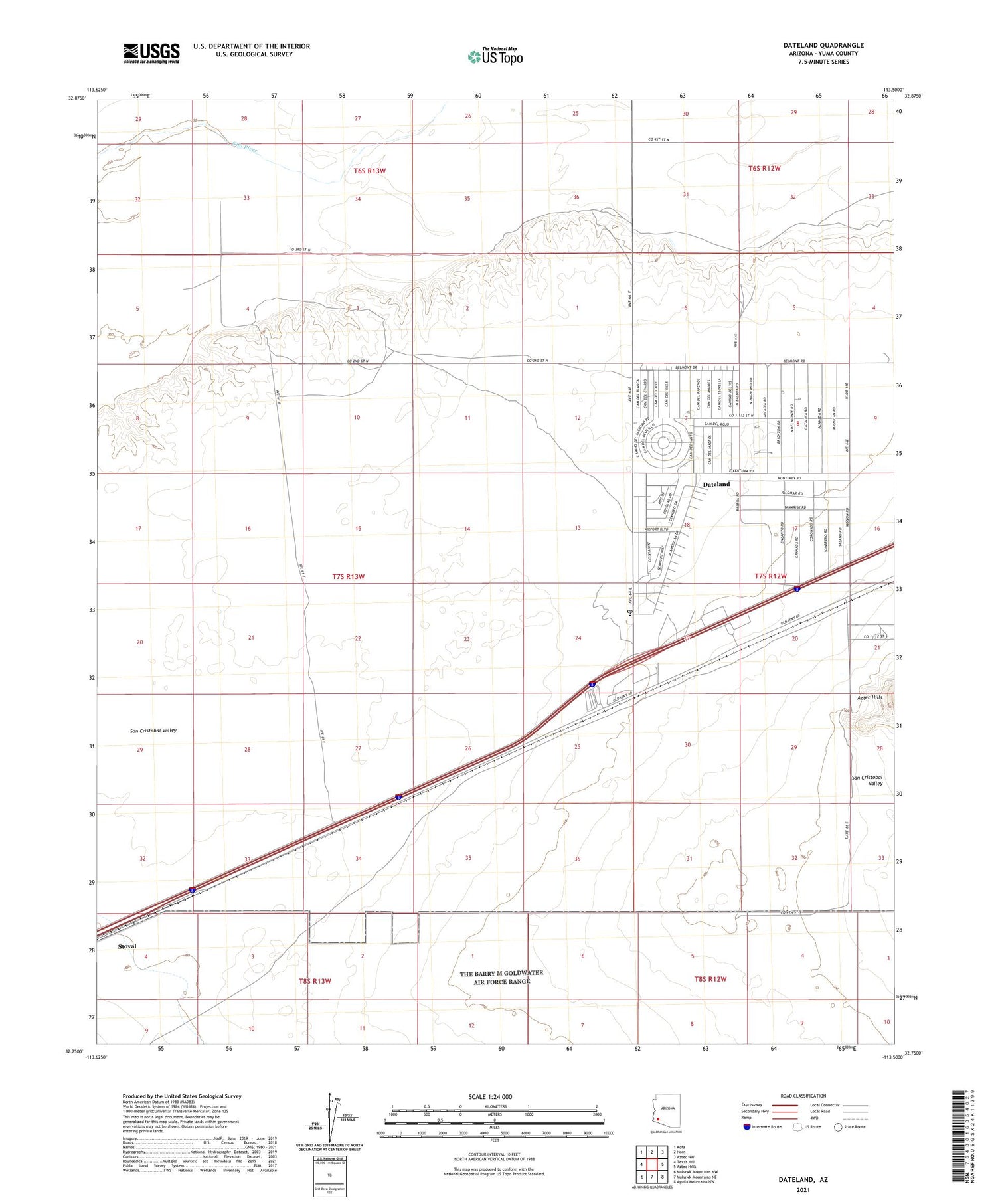
2021 topographic map quadrangle Dateland in the state of Arizona. Scale: 1:24000. Based on the newly updated USGS 7.5' US Topo map series, this map is in the following counties: Yuma. The map contains contour data, water features, and other items you are used to seeing on USGS maps, but also has updated roads and other features. This is the next generation of topographic maps. Printed on high-quality waterproof paper with UV fade-resistant inks.
Quads adjacent to this one:
West: Texas Hill
Northwest: Kofa
North: Horn
Northeast: Aztec NW
East: Aztec Hills
Southeast: Aguila Mountains NW
South: Mohawk Mountains NE
Southwest: Mohawk Mountains NW
This map covers the same area as the classic USGS quad with code o32113g5.
Contains the following named places: Datelan Army Air Field, Dateland, Dateland Airfield, Dateland Census Designated Place, Dateland Elementary School, Dateland Highway Yard, Dateland Library, Dateland Radar Tower, Stoval