MyTopo
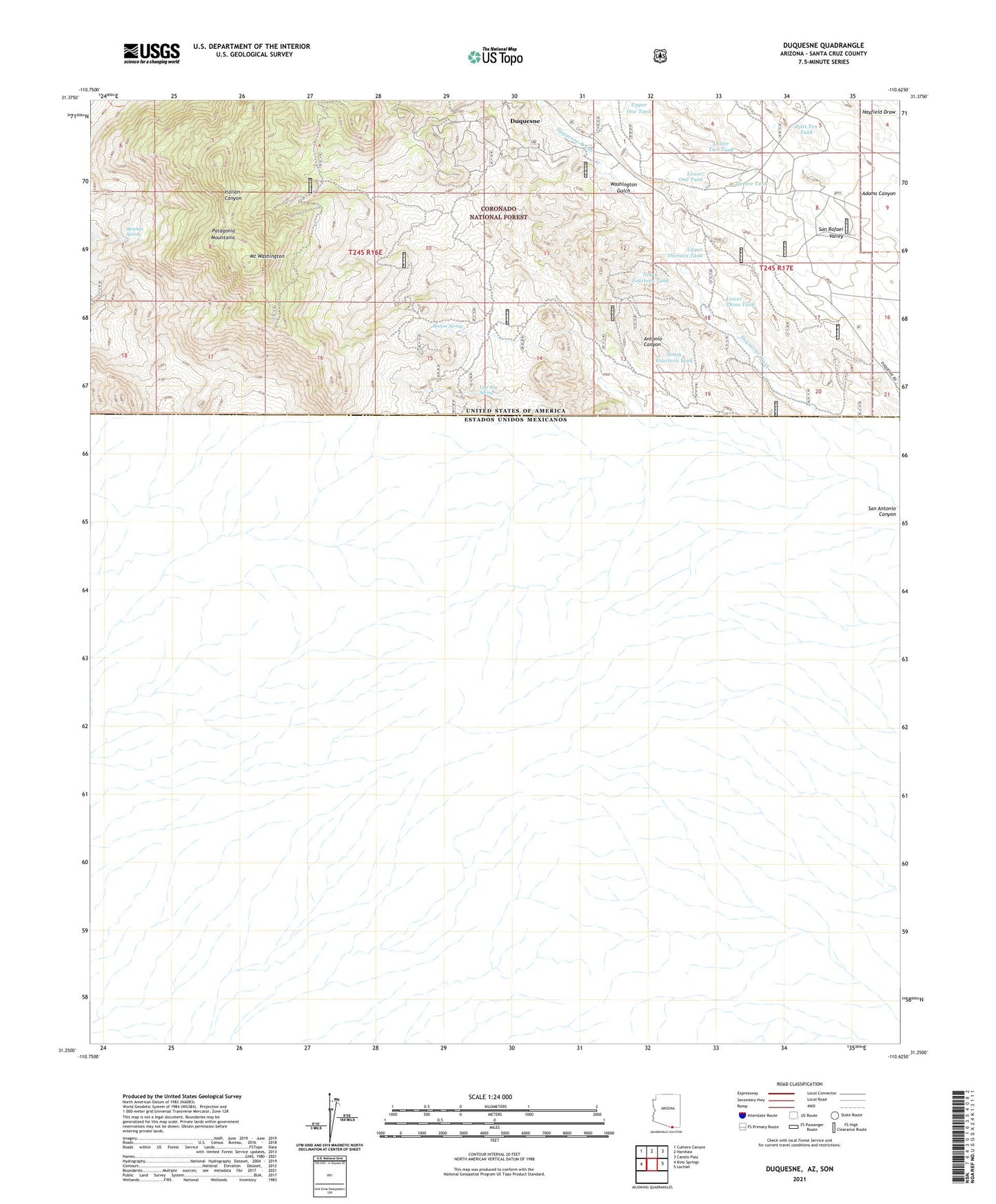
Duquesne Arizona US Topo Map
Couldn't load pickup availability
Also explore the Duquesne Forest Service Topo of this same quad for updated USFS data
2021 topographic map quadrangle Duquesne in the state of Arizona. Scale: 1:24000. Based on the newly updated USGS 7.5' US Topo map series, this map is in the following counties: Santa Cruz. The map contains contour data, water features, and other items you are used to seeing on USGS maps, but also has updated roads and other features. This is the next generation of topographic maps. Printed on high-quality waterproof paper with UV fade-resistant inks.
Quads adjacent to this one:
West: Kino Springs
Northwest: Cumero Canyon
North: Harshaw
Northeast: Canelo Pass
East: Lochiel
This map covers the same area as the classic USGS quad with code o31110c6.
Contains the following named places: Antonio Canyon, Antonio Tank, Belmont Mine, Benches Spring, Benton Mine, Benton Spring, Bonanza Mine, Callahan Corral, Dudley Mine, Duquesne, Duquesne Corral, Duquesne Mine, East Ten Tank, Empire Mine, Everett Windmill, Fray Marcos de Niza Historical Monument, Government Corral, Heady-Ashburn Ranch, Holland Mine, Line Boy Mine, Line Boy Spring, Lower One Tank, Lower Thirteen Tank, Lower Three Tank, Lower Two Tank, Mount Washington, North Fourteen Tank, North Tank, Paradise Canyon Mine, Patagonia Mountains, San Antonio Canyon, San Rafael State Park, Santa Nino Corral, Santo Nino Mine, South Fourteen Tank, Texas Mine, Trask Ranch, Twelve Tank, Upper One Tank, Upper Thirteen Tank, Washington Gulch