MyTopo
Grayback Mountains Arizona US Topo Map
Couldn't load pickup availability
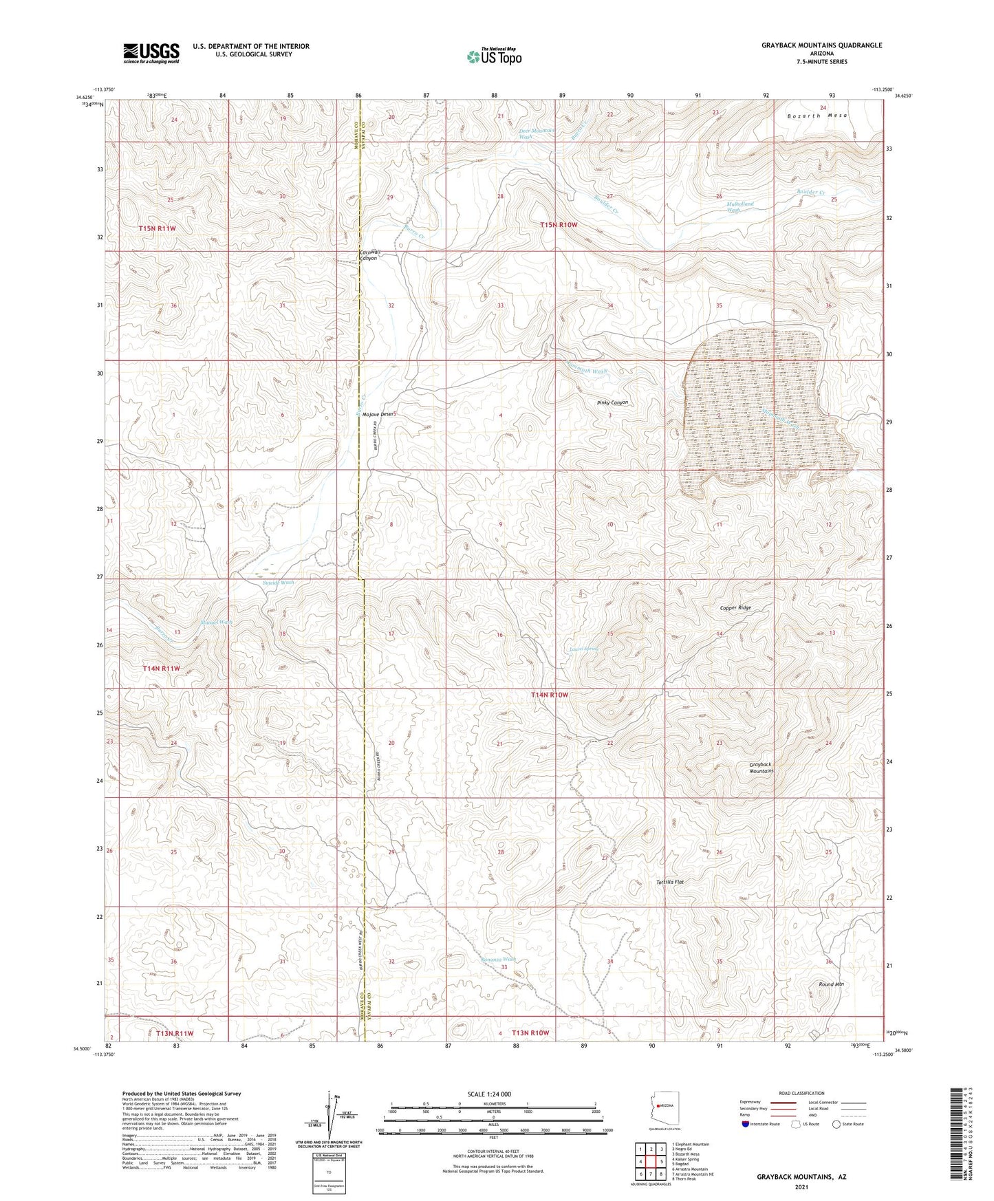
2021 topographic map quadrangle Grayback Mountains in the state of Arizona. Scale: 1:24000. Based on the newly updated USGS 7.5' US Topo map series, this map is in the following counties: Yavapai, Mohave. The map contains contour data, water features, and other items you are used to seeing on USGS maps, but also has updated roads and other features. This is the next generation of topographic maps. Printed on high-quality waterproof paper with UV fade-resistant inks.
Quads adjacent to this one:
West: Kaiser Spring
Northwest: Elephant Mountain
North: Negro Ed
Northeast: Bozarth Mesa
East: Bagdad
Southeast: Thorn Peak
South: Arrastra Mountain NE
Southwest: Arrastra Mountain
This map covers the same area as the classic USGS quad with code o34113e3.
Contains the following named places: Agate Well, Bland Mine, Boulder Creek, Coors Mine, Coors Well, Copper Ridge, Cornwall Canyon, Deer Mountain Wash, Grayback Mountains, Key Mine, Laurel Spring, Lower Cornwall Well, Mammoth Wash, Manuel Wash, Mulholland Wash, New Olea Well, North Fork Well, Pack Rat Well, Round Mountain, Round Mountain Well, Six Mile Crossing, Suicide Wash, Tortilla Flat, Zana Canyon, Zannaropolis Mine