MyTopo
Hindu Canyon Arizona US Topo Map
Couldn't load pickup availability
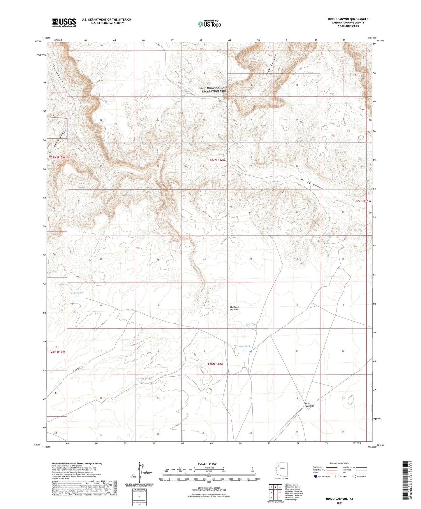
2021 topographic map quadrangle Hindu Canyon in the state of Arizona. Scale: 1:24000. Based on the newly updated USGS 7.5' US Topo map series, this map is in the following counties: Mohave. The map contains contour data, water features, and other items you are used to seeing on USGS maps, but also has updated roads and other features. This is the next generation of topographic maps. Printed on high-quality waterproof paper with UV fade-resistant inks.
Quads adjacent to this one:
West: Milkweed Canyon NW
Northwest: Spencer Canyon
North: Separation Canyon
Northeast: Travertine Rapids
East: Peach Springs Canyon
Southeast: Peach Springs
South: Milkweed Canyon SE
Southwest: Milkweed Canyon SW
This map covers the same area as the classic USGS quad with code o35113f5.
Contains the following named places: Bender Tank, Crozier Tank, Hindu Canyon, Milkweed Canyon, Plain Tank, Plain Tank Flat, Siple Tank, ZIP Code: 86434