
MyTopo
Imperial Reservoir Arizona US Topo Map
Couldn't load pickup availability
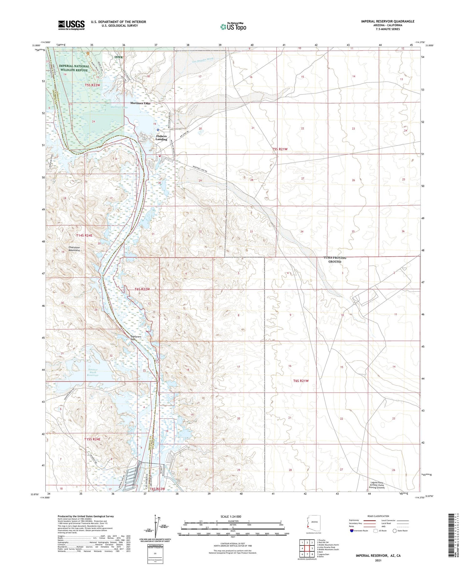
2023 topographic map quadrangle Imperial Reservoir in the states of Arizona, California. Scale: 1:24000. Based on the newly updated USGS 7.5' US Topo map series, this map is in the following counties: Yuma, Imperial. The map contains contour data, water features, and other items you are used to seeing on USGS maps, but also has updated roads and other features. This is the next generation of topographic maps. Printed on high-quality waterproof paper with UV fade-resistant inks.
Quads adjacent to this one:
West: Little Picacho Peak
Northwest: Picacho
North: Red Hill SW
Northeast: Middle Mountains North
East: Middle Mountains South
Southeast: Dome
South: Laguna Dam
Southwest: Bard
Contains the following named places: Boy Scout Camp, Castle Dome Landing, Explorers Pass, Ferguson Wash, Fishers Landing, Fishers Landing Airport, Harwood, Imperial Dam, Los Angeles Wash, Martinez Lake, Martinez Lake Census Designated Place, North Dike Dam, Old Senator Mine, Rural / Metro Fire Department Station 6, Senator Wash, Senator Wash Dam, Senator Wash Reservoir, Squaw Lake, Squaw Lake Dike Dam, Yuma County Sheriff's Office District 4 - Martinez Lake


