MyTopo
Kom Vo Arizona US Topo Map
Couldn't load pickup availability
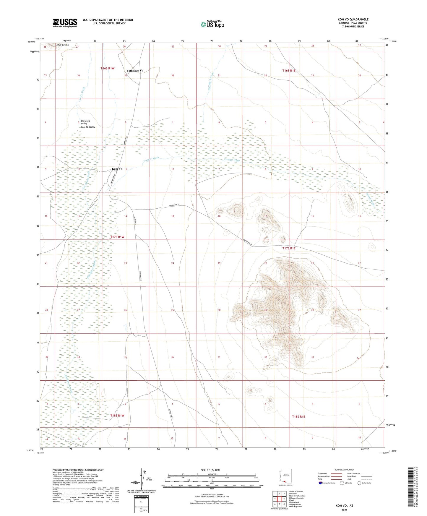
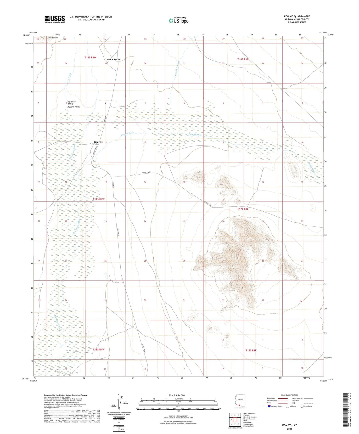
2021 topographic map quadrangle Kom Vo in the state of Arizona. Scale: 1:24000. Based on the newly updated USGS 7.5' US Topo map series, this map is in the following counties: Pima. The map contains contour data, water features, and other items you are used to seeing on USGS maps, but also has updated roads and other features. This is the next generation of topographic maps. Printed on high-quality waterproof paper with UV fade-resistant inks.
Quads adjacent to this one:
West: Chupan Mountain
Northwest: West of Pisinimo
North: Pisinimo
Northeast: Ben Nevis Mountain
East: Kupk
Southeast: Kots Kug Ranch
South: Papago Farms
Southwest: Bailey Peak
This map covers the same area as the classic USGS quad with code o31112h3.
Contains the following named places: Hali Murk Wash, Kom Vo, Kupk Hills, Quijotoa Valley, Tatk Kam Vo, Vamori Wash