MyTopo
Mud Spring Arizona US Topo Map
Couldn't load pickup availability
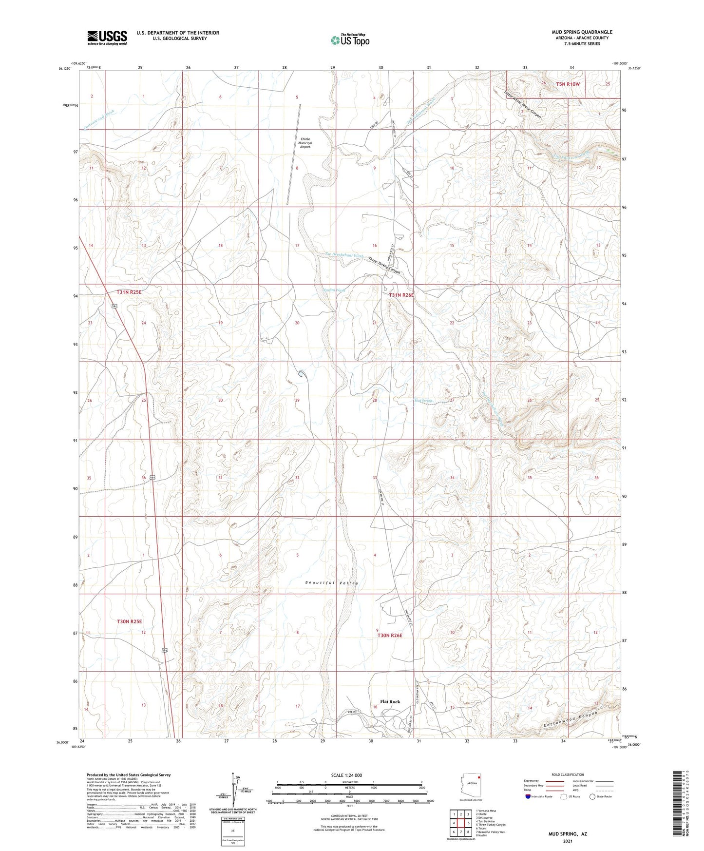
2021 topographic map quadrangle Mud Spring in the state of Arizona. Scale: 1:24000. Based on the newly updated USGS 7.5' US Topo map series, this map is in the following counties: Apache. The map contains contour data, water features, and other items you are used to seeing on USGS maps, but also has updated roads and other features. This is the next generation of topographic maps. Printed on high-quality waterproof paper with UV fade-resistant inks.
Quads adjacent to this one:
West: Toh De Niihe
Northwest: Ventana Mesa
North: Chinle
Northeast: Del Muerto
East: Three Turkey Canyon
Southeast: Nazlini
South: Beautiful Valley Well
Southwest: Tolani
Contains the following named places: Bis Ii Ah Wash, Chinle Municipal Airport, Flat Rock, Flat Rock Windmill, Little White House Canyon, Mud Spring, Sandy Hill Well, Taylor Reservoir Dam, Three Turkey Canyon, Tiis Ndiitsooi Wash, Tse Deeshzhaai Wash