MyTopo
Rock Point Arizona US Topo Map
Couldn't load pickup availability
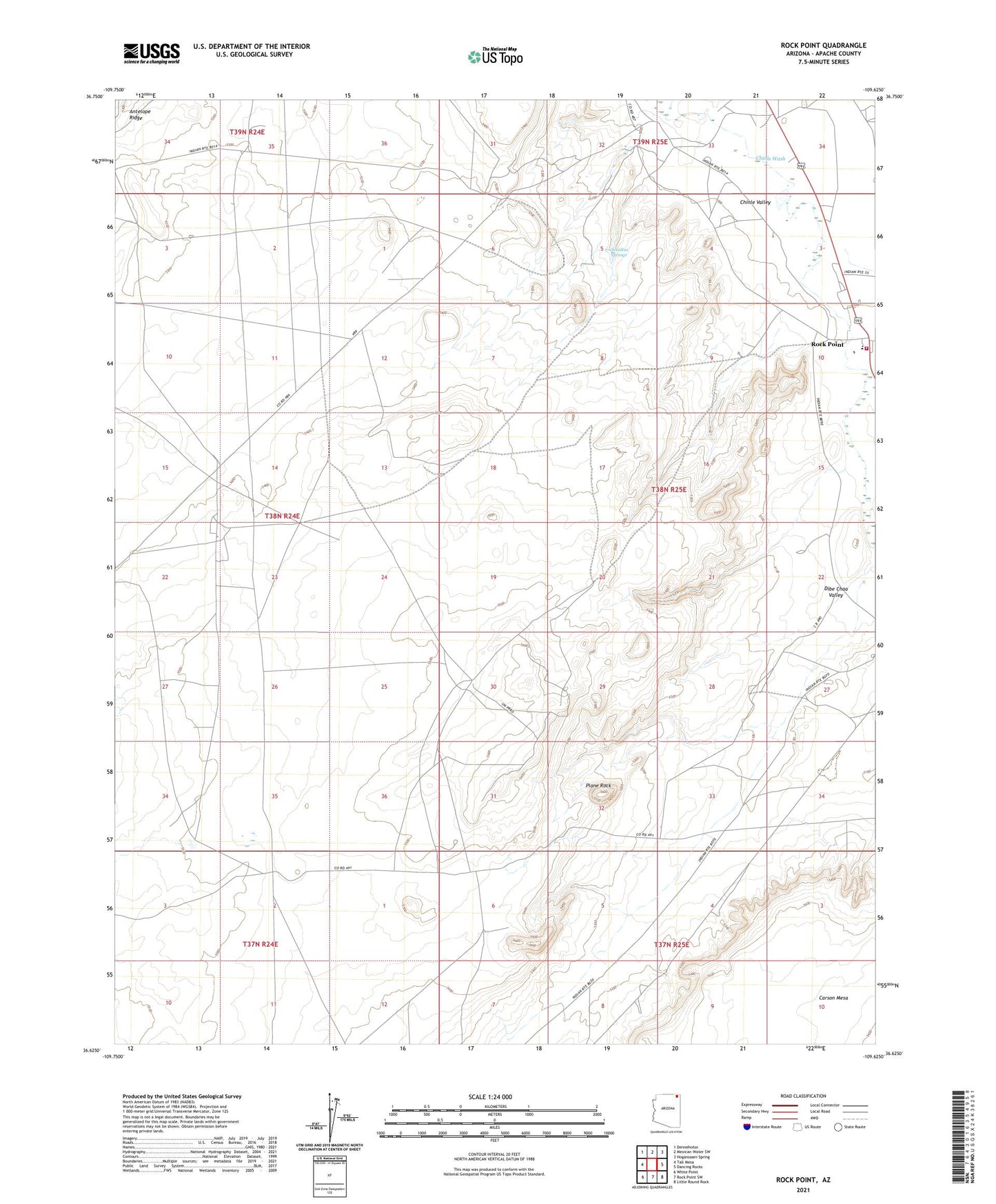
2021 topographic map quadrangle Rock Point in the state of Arizona. Scale: 1:24000. Based on the newly updated USGS 7.5' US Topo map series, this map is in the following counties: Apache. The map contains contour data, water features, and other items you are used to seeing on USGS maps, but also has updated roads and other features. This is the next generation of topographic maps. Printed on high-quality waterproof paper with UV fade-resistant inks.
Quads adjacent to this one:
West: Tall Mesa
Northwest: Dennehotso
North: Mexican Water SW
Northeast: Hogansaani Spring
East: Dancing Rocks
Southeast: Little Round Rock
South: Rock Point SW
Southwest: White Point
This map covers the same area as the classic USGS quad with code o36109f6.
Contains the following named places: Dibe Chaa Valley, Navajo Lutheran Mission School, Plane Rock, Rock Point, Rock Point Census Designated Place, Rock Point Community School Fire Department, Rock Point Trading Post, Setsiltso Springs