MyTopo
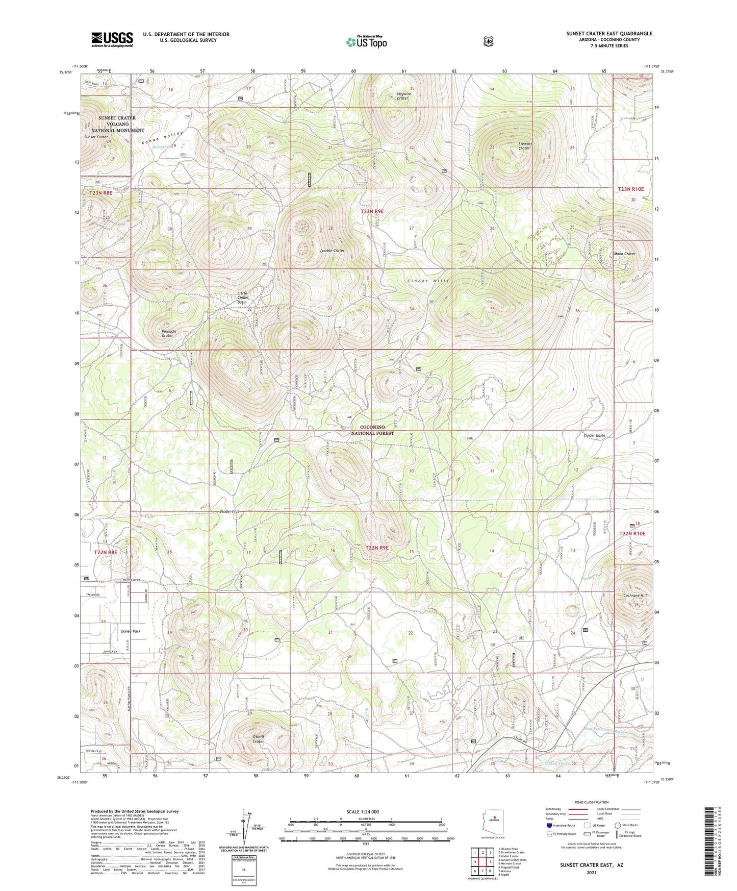
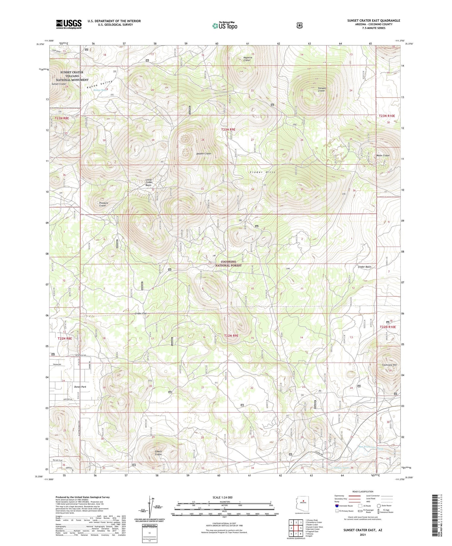
Sunset Crater East Arizona US Topo Map
Couldn't load pickup availability
Also explore the Sunset Crater East Forest Service Topo of this same quad for updated USFS data
2021 topographic map quadrangle Sunset Crater East in the state of Arizona. Scale: 1:24000. Based on the newly updated USGS 7.5' US Topo map series, this map is in the following counties: Coconino. The map contains contour data, water features, and other items you are used to seeing on USGS maps, but also has updated roads and other features. This is the next generation of topographic maps. Printed on high-quality waterproof paper with UV fade-resistant inks.
Quads adjacent to this one:
West: Sunset Crater West
North: Strawberry Crater
Northeast: Roden Crater
East: Merriam Crater
Southeast: Angell
South: Winona
Southwest: Flagstaff East
This map covers the same area as the classic USGS quad with code o35111c4.
Contains the following named places: Browse Tank, Cinder Basin, Cinder Flat, Cinder Hills, Cinder Hills Overlook, Cochrane Hill, Double Crater, Haywire Crater, Little Cinder Basin, Moon Crater, O'Neill Crater, Pinnacle Crater, Stewart Crater, Trick Tank, Turkey Tank, Turkey Tanks