MyTopo
Valle Bonito NE Arizona US Topo Map
Couldn't load pickup availability
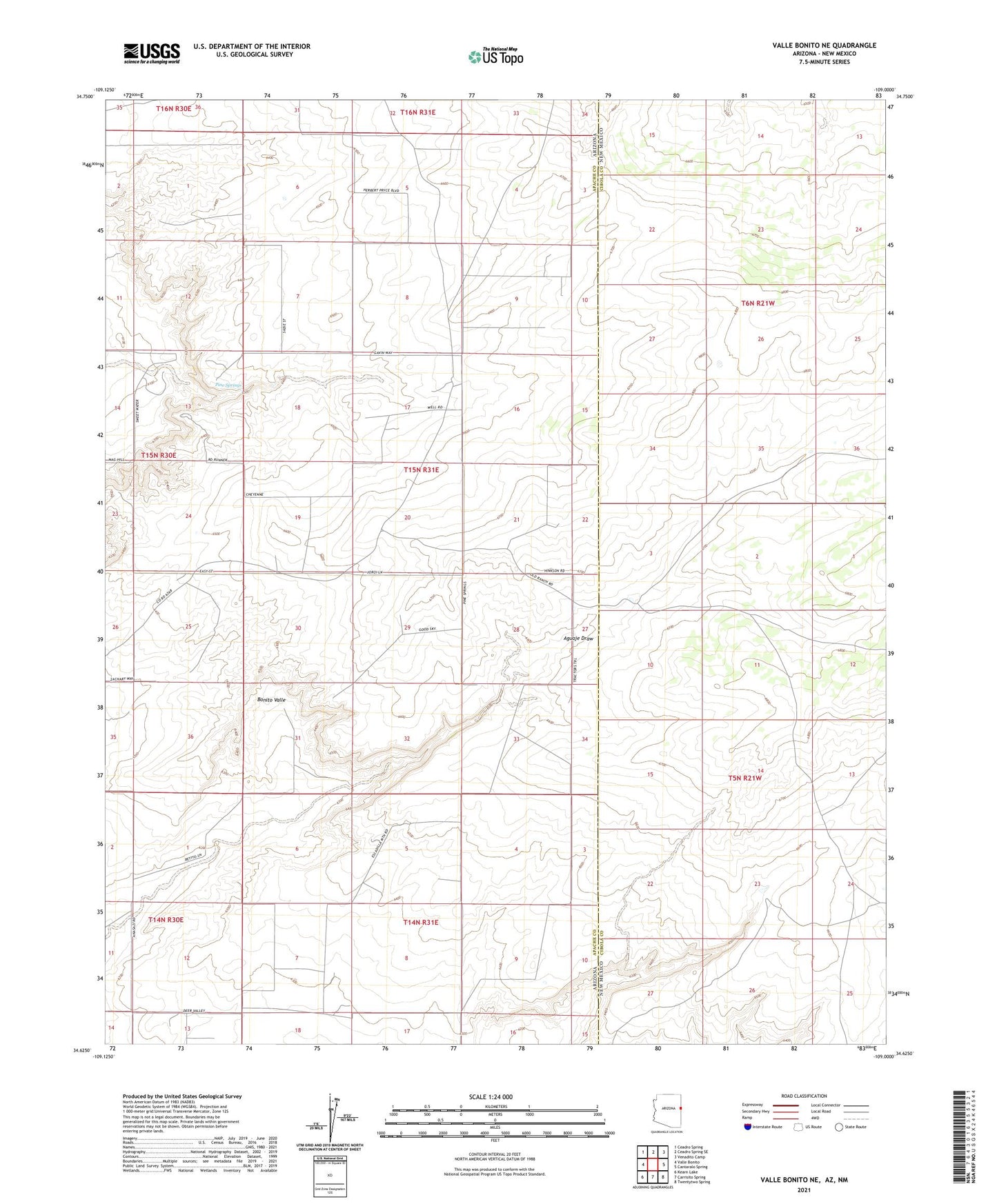
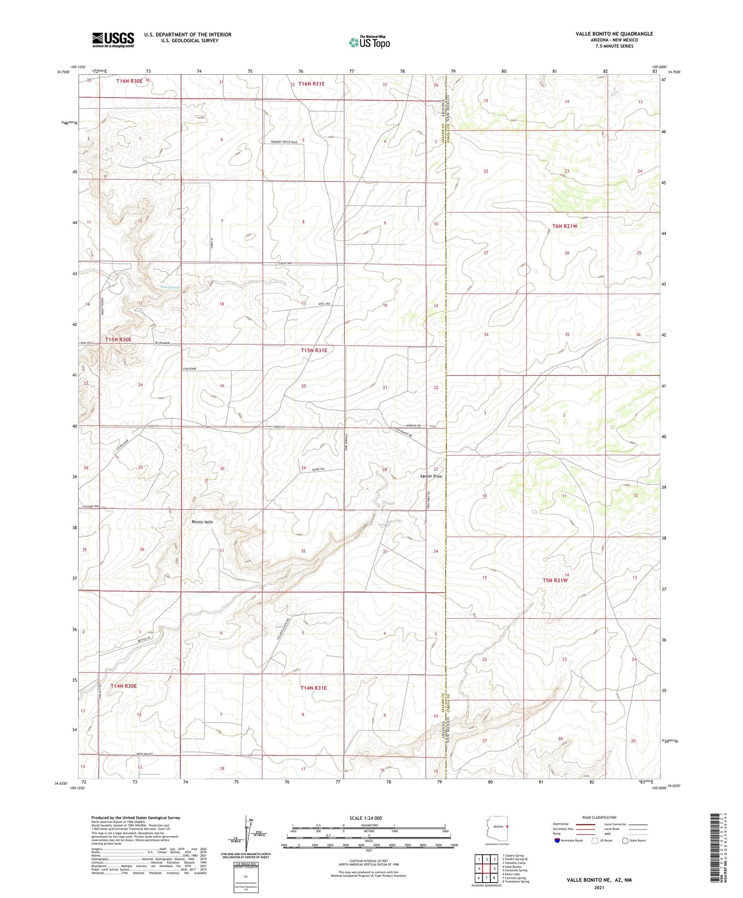
2021 topographic map quadrangle Valle Bonito NE in the states of Arizona, New Mexico. Scale: 1:24000. Based on the newly updated USGS 7.5' US Topo map series, this map is in the following counties: Apache, Cibola. The map contains contour data, water features, and other items you are used to seeing on USGS maps, but also has updated roads and other features. This is the next generation of topographic maps. Printed on high-quality waterproof paper with UV fade-resistant inks.
Quads adjacent to this one:
West: Valle Bonito
Northwest: Ceadro Spring
North: Ceadro Spring SE
Northeast: Venadito Camp
East: Cantaralo Spring
Southeast: Twentytwo Spring
South: Carrisito Spring
Southwest: Kearn Lake
Contains the following named places: Lynch Ranch, Lynch Water Well, Pine Springs, Pine Springs Well