MyTopo
Wildcat Well Arizona US Topo Map
Couldn't load pickup availability
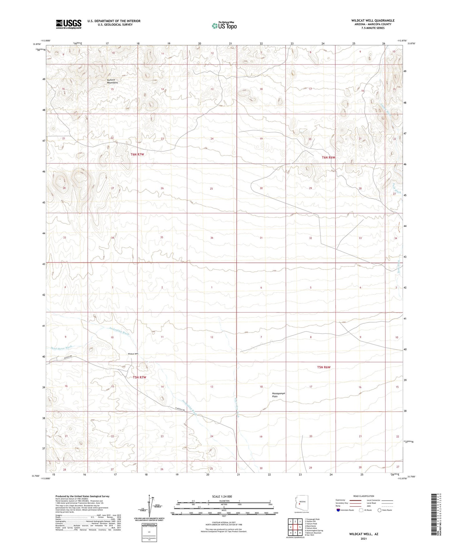
2021 topographic map quadrangle Wildcat Well in the state of Arizona. Scale: 1:24000. Based on the newly updated USGS 7.5' US Topo map series, this map is in the following counties: Maricopa. The map contains contour data, water features, and other items you are used to seeing on USGS maps, but also has updated roads and other features. This is the next generation of topographic maps. Printed on high-quality waterproof paper with UV fade-resistant inks.
Quads adjacent to this one:
West: Black Butte
Northwest: Forepaugh Peak
North: Outlaw Hill
Northeast: Vulture Peak
East: Vulture Mine
Southeast: Star Well
South: Belmont Mountain
Southwest: Hummingbird Spring
This map covers the same area as the classic USGS quad with code o33112g8.
Contains the following named places: Dead Horse Wash, Hassayampa Plain, Jackrabbit Wash, Wildcat Well