MyTopo
Zion Reservoir Arizona US Topo Map
Couldn't load pickup availability
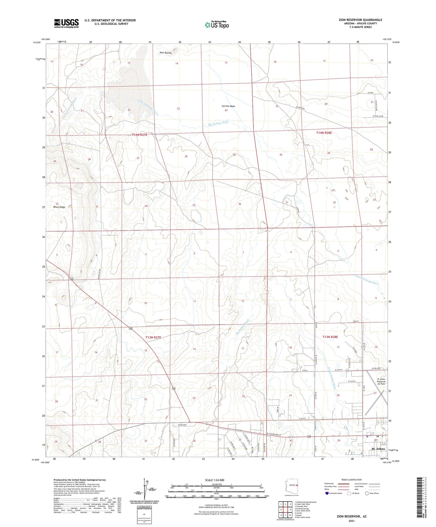
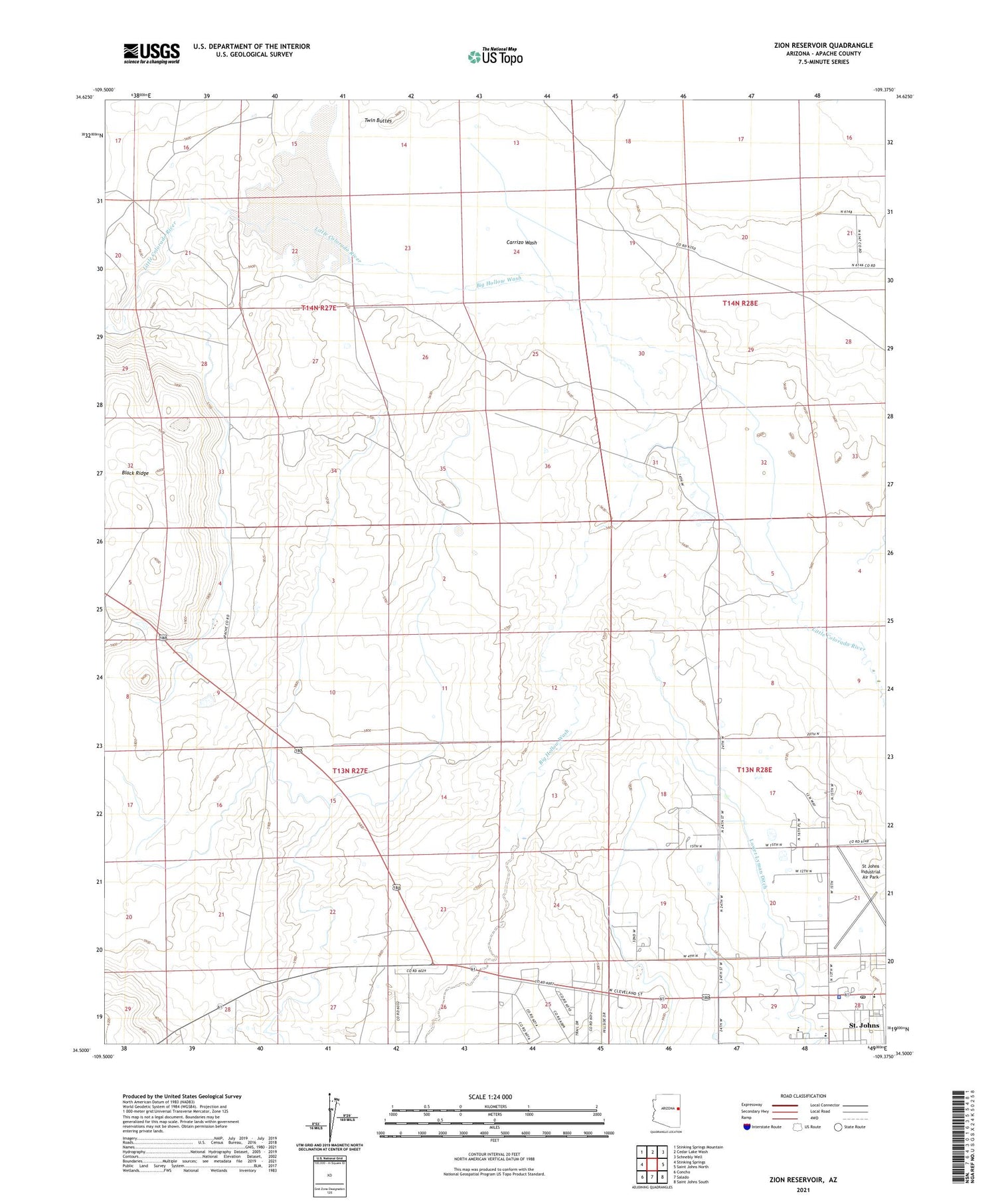
2021 topographic map quadrangle Zion Reservoir in the state of Arizona. Scale: 1:24000. Based on the newly updated USGS 7.5' US Topo map series, this map is in the following counties: Apache. The map contains contour data, water features, and other items you are used to seeing on USGS maps, but also has updated roads and other features. This is the next generation of topographic maps. Printed on high-quality waterproof paper with UV fade-resistant inks.
Quads adjacent to this one:
West: Stinking Springs
Northwest: Stinking Springs Mountain
North: Cedar Lake Wash
Northeast: Schnebly Well
East: Saint Johns North
Southeast: Saint Johns South
South: Salado
Southwest: Concho
This map covers the same area as the classic USGS quad with code o34109e4.
Contains the following named places: Apache County Fairgrounds, Big Hollow Wash, Carrizo Wash, City of Saint Johns, First Baptist Church, Heap Place, Lower Lyman Ditch, New Covenant Church, New Visions Academy - Saint John's Campus, Saint Johns High School, Saint Johns Police Department, Saint Johns Post Office, St Johns Industrial Air Park, Twin Buttes, Zion Dam, Zion Reservoir