MyTopo
Brentwood Arkansas US Topo Map
Couldn't load pickup availability
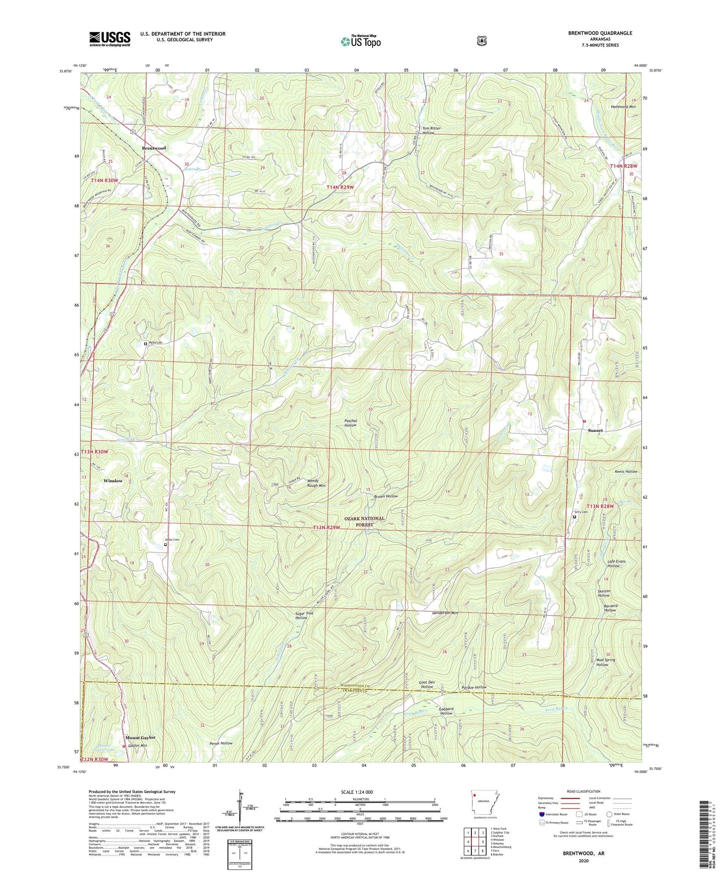
2024 topographic map quadrangle Brentwood in the state of Arkansas. Scale: 1:24000. Based on the newly updated USGS 7.5' US Topo map series, this map is in the following counties: Washington, Crawford. The map contains contour data, water features, and other items you are used to seeing on USGS maps, but also has updated roads and other features. This is the next generation of topographic maps. Printed on high-quality waterproof paper with UV fade-resistant inks.
Quads adjacent to this one:
West: Winslow
Northwest: West Fork
North: Sulphur City
Northeast: Durham
East: Delaney
Southeast: Bidville
South: Fern
Southwest: Mountainburg
This map covers the same area as the classic USGS quad with code o35094g1.
Contains the following named places: Arnett Church, Barnard Hollow, Bee Branch, Black Oak Church, Brentwood, Brown Hollow, Coil Cemetery, Dry Creek, Gabbard Hollow, Gaylor Mountain, Goat Den Hollow, Henderson Mountain, Hutchins Creek, Jones Branch, KAFT-TV (Fayetteville), Keets Hollow, KEZA-FM (Fayetteville), KUAF-FM (Fayetteville), Lafe Evans Hollow, London Creek, Low Gap, Mast Creek, Millers Chapel, Mount Gaylor, Mount Gaylor Lake, Mount Gaylor Lake Dam, Mount Gaylor Lookout Tower, Mud Spring Hollow, Our Lady of the Ozarks Shrine, Parks Cemetery, Paschal Hollow, Pense Hollow, Porters Store, Purdue Hollow, Rural District 8 Station 1, Shrader Branch, Skelton Hollow, Sugar Tree Hollow, Sunset, Sunset Post Office, Sunset Volunteer Fire Department, Terry Cemetery, Tom Ritter Hollow, Township of Crawford, Township of Winslow, Weedy Rough Mountain, Weedy Rough Mountain Lookout Tower, ZIP Code: 72959