MyTopo
Prairie Grove Arkansas US Topo Map
Couldn't load pickup availability
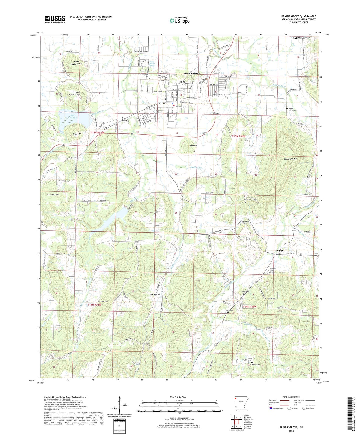
2024 topographic map quadrangle Prairie Grove in the state of Arkansas. Scale: 1:24000. Based on the newly updated USGS 7.5' US Topo map series, this map is in the following counties: Washington. The map contains contour data, water features, and other items you are used to seeing on USGS maps, but also has updated roads and other features. This is the next generation of topographic maps. Printed on high-quality waterproof paper with UV fade-resistant inks.
Quads adjacent to this one:
West: Lincoln
Northwest: Rhea
North: Wheeler
Northeast: Fayetteville
East: West Fork
Southeast: Winslow
South: Strickler
Southwest: Evansville
This map covers the same area as the classic USGS quad with code o35094h3.
Contains the following named places: Big Spring, Big Spring Church, Billingsley Cemetery, Billingsley Church, Blair Creek, Budd Kidd Creek, Budd Kidd Lake, Cane Hill Mountain, Center Point Church, Centre Point School, City of Prairie Grove, Hickory Creek, Hogeye, Hogeye Creek, Howell Cemetery, Hubbard, Hubbard Post Office, Illinois Chapel, Illinois Chapel Cemetery, Lake Prairie Grove, Liberty School, Living Waters Spring, Mc Donald Cemetery, Moffit Post Office, Muddy Fork of Illinois Site Number 3 Dam, New Hope Cemetery, New Hope Community Hall, New Hope School, New Sulphur Church, North Mayberry Mountain, Parks Cemetery, Pinnacle, Prairie Grove, Prairie Grove Battlefield State Park, Prairie Grove Elementary School, Prairie Grove Fire Department, Prairie Grove High School, Prairie Grove Lake Dam, Prairie Grove Middle School, Prairie Grove Post Office, Prairie Grove Upper Elementary School, Prarie Grove Police Department, Rutherford Cemetery, Sharp Cemetery, South Mayberry Mountain, Stevenson Mountain, Sulphur Fork, Sweetwater Creek, Township of Prairie Grove, Township of Valley, Wolf Mountain, ZIP Code: 72753