MyTopo
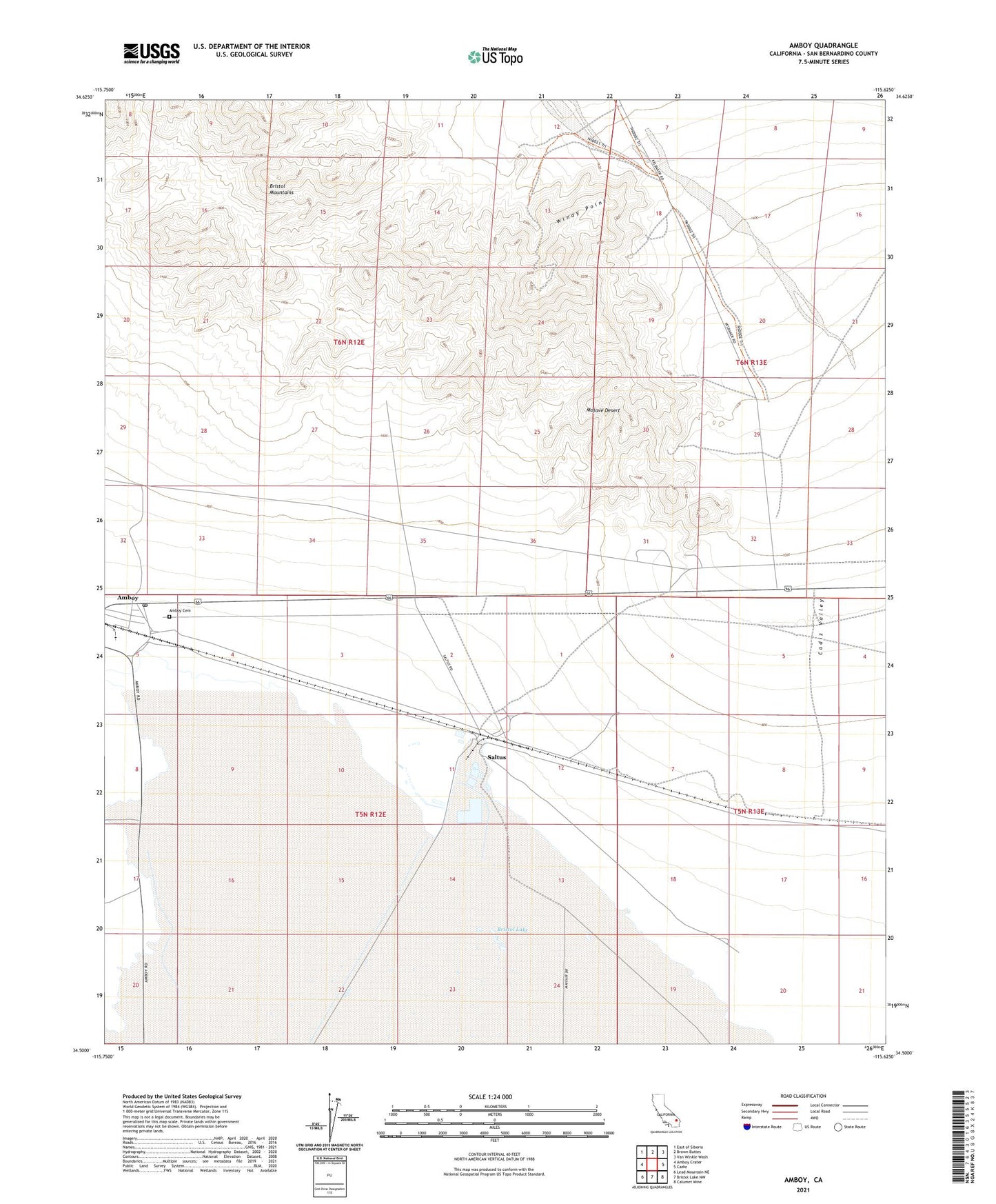
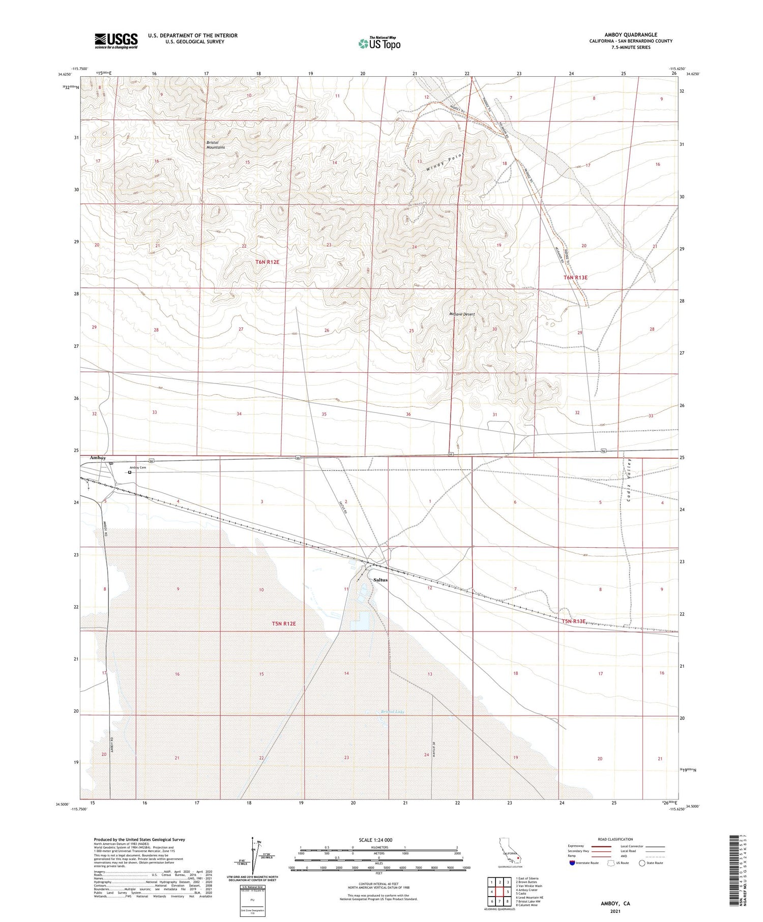
Amboy California US Topo Map
Couldn't load pickup availability
2021 topographic map quadrangle Amboy in the state of California. Scale: 1:24000. Based on the newly updated USGS 7.5' US Topo map series, this map is in the following counties: San Bernardino. The map contains contour data, water features, and other items you are used to seeing on USGS maps, but also has updated roads and other features. This is the next generation of topographic maps. Printed on high-quality waterproof paper with UV fade-resistant inks.
Quads adjacent to this one:
West: Amboy Crater
Northwest: East of Siberia
North: Brown Buttes
Northeast: Van Winkle Wash
East: Cadiz
Southeast: Calumet Mine
South: Bristol Lake NW
Southwest: Lead Mountain NE
This map covers the same area as the classic USGS quad with code o34115e6.
Contains the following named places: Amboy, Amboy Elementary School, Orange Blossom Wash, Saltus, Windy Point, ZIP Code: 92304