MyTopo
Blackwells Corner California US Topo Map
Couldn't load pickup availability
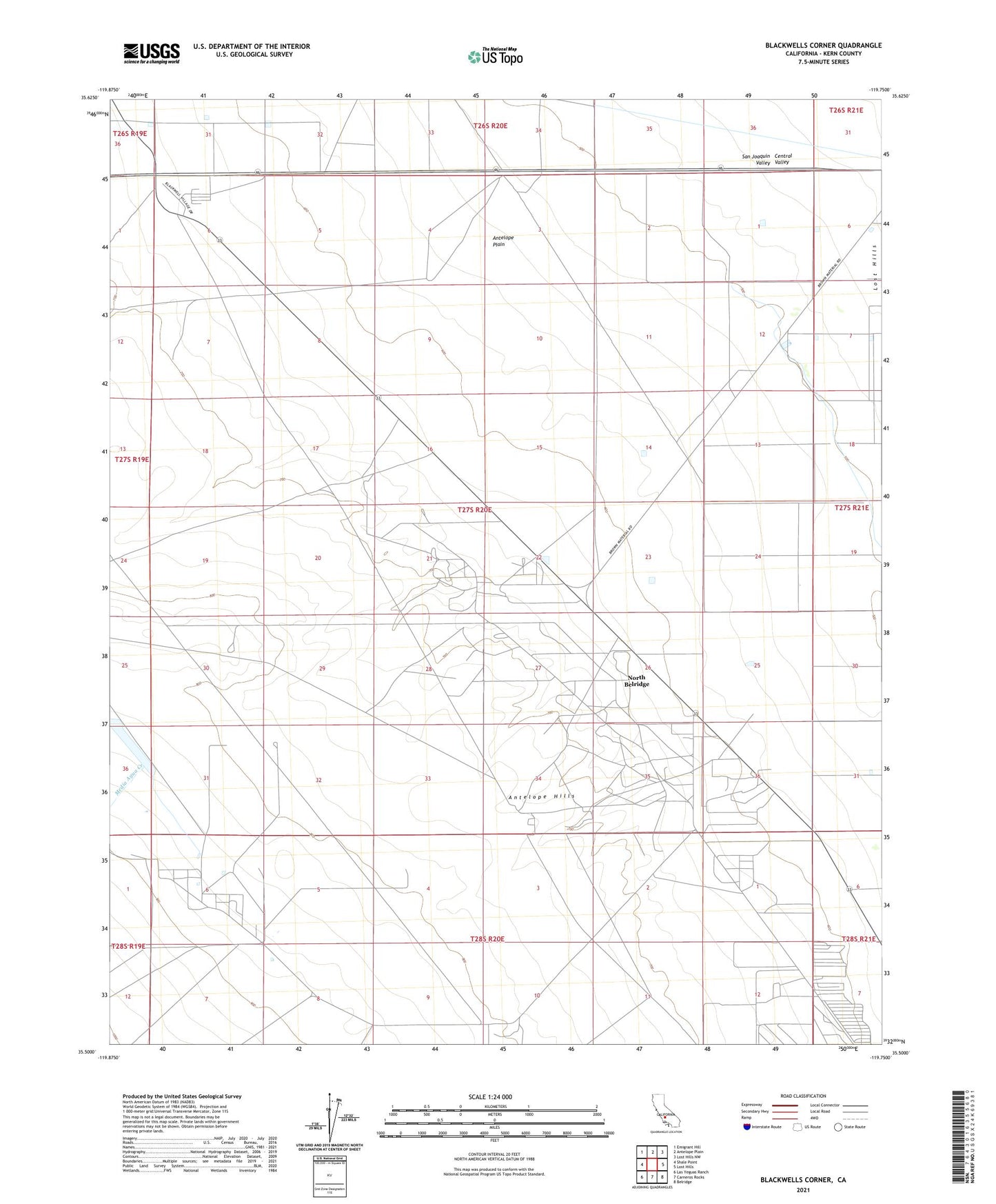
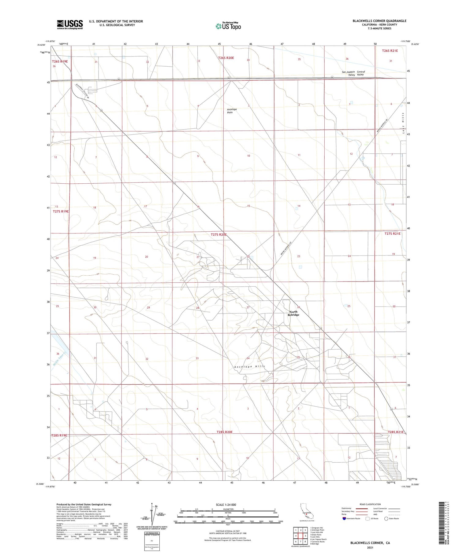
2021 topographic map quadrangle Blackwells Corner in the state of California. Scale: 1:24000. Based on the newly updated USGS 7.5' US Topo map series, this map is in the following counties: Kern. The map contains contour data, water features, and other items you are used to seeing on USGS maps, but also has updated roads and other features. This is the next generation of topographic maps. Printed on high-quality waterproof paper with UV fade-resistant inks.
Quads adjacent to this one:
West: Shale Point
Northwest: Emigrant Hill
North: Antelope Plain
Northeast: Lost Hills NW
East: Lost Hills
Southeast: Belridge
South: Carneros Rocks
Southwest: Las Yeguas Ranch
This map covers the same area as the classic USGS quad with code o35119e7.
Contains the following named places: Antelope Hills, Antelope Hills Oil Field, Blackwells Corner, Carneros Pumping Station, McDonald Anti-Cline Oil Field, Middlewater Pumping Station, North Belridge, North Belridge Oil Field