MyTopo
Frink California US Topo Map
Couldn't load pickup availability
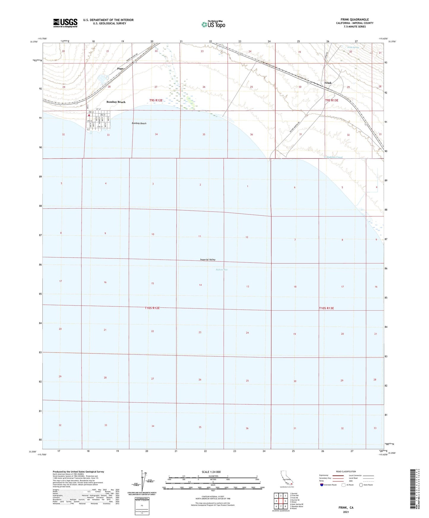
2021 topographic map quadrangle Frink in the state of California. Scale: 1:24000. Based on the newly updated USGS 7.5' US Topo map series, this map is in the following counties: Imperial. The map contains contour data, water features, and other items you are used to seeing on USGS maps, but also has updated roads and other features. This is the next generation of topographic maps. Printed on high-quality waterproof paper with UV fade-resistant inks.
Quads adjacent to this one:
West: Durmid SE
Northwest: Durmid
North: Frink NW
Northeast: Frink NE
East: Wister
Southeast: Niland
South: Obsidian Butte
Southwest: Kane Spring NE
This map covers the same area as the classic USGS quad with code o33115c6.
Contains the following named places: Bombay Beach, Bombay Beach Campground, Bombay Beach Census Designated Place, Frink, Frink Spring, Imperial County Fire Station - Bombay Beach, Niland Marina, Pope