MyTopo
Heber California US Topo Map
Couldn't load pickup availability
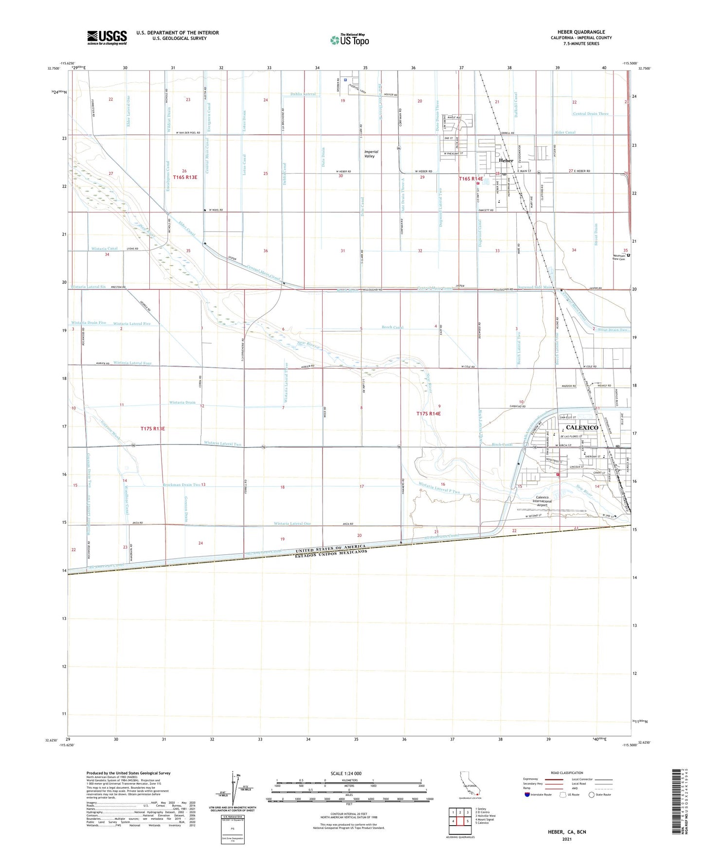
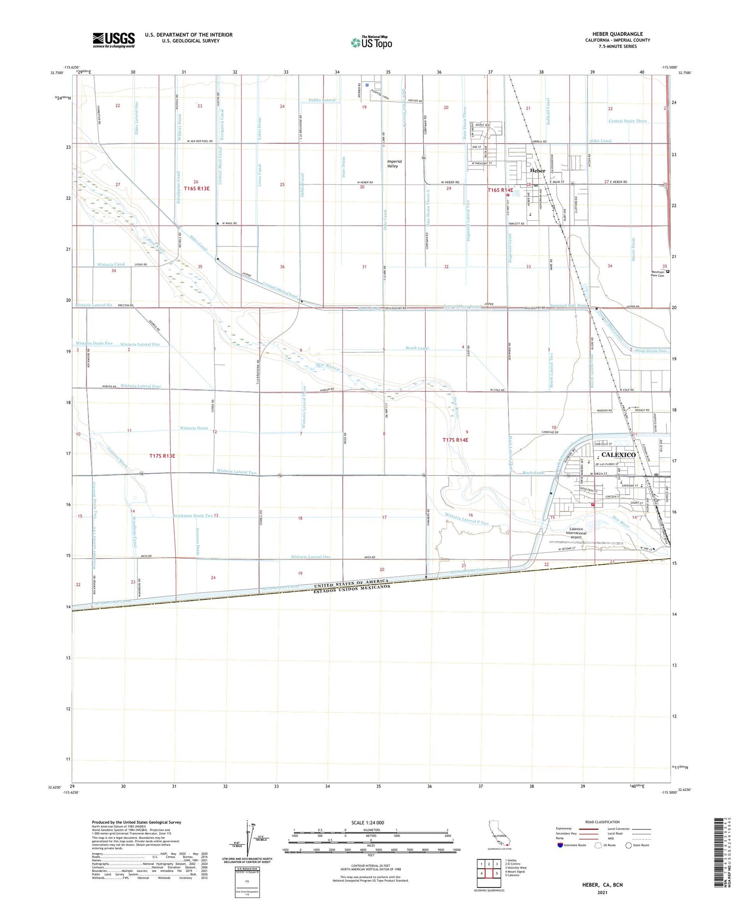
2021 topographic map quadrangle Heber in the state of California. Scale: 1:24000. Based on the newly updated USGS 7.5' US Topo map series, this map is in the following counties: Imperial. The map contains contour data, water features, and other items you are used to seeing on USGS maps, but also has updated roads and other features. This is the next generation of topographic maps. Printed on high-quality waterproof paper with UV fade-resistant inks.
Quads adjacent to this one:
West: Mount Signal
Northwest: Seeley
North: El Centro
Northeast: Holtville West
East: Calexico
This map covers the same area as the classic USGS quad with code o32115f5.
Contains the following named places: Alder Lateral Five A, Beech Canal, Beech Drain, Beech Lateral One, Beech Lateral Two, Birch Canal, Birch Lateral Three, Brockman Drain Two, Calexico Fire Department Station 2, Calexico International Airport, Calexico Mall Shopping Center, Calexico Post Office, Central Drain, Daffodil Canal, Date Drain Three, Date Drain Three-A, Dogwood Lateral Two, Dogwood Side Main, Elder Lateral One, Greeson Drain, Greeson Drain Two, Heber, Heber Census Designated Place, Heber Elementary School, Heber Junior High School, Heber Park, Heber Post Office, Imperial County Fire Department Station 2, Imperial County Hospital, Imperial County Sheriff's Office - South County Station, International Country Club, Johnson Brothers Airport, KICO-AM (Calexico), Legion Park, Lotus Canal, Lotus Drain, Lyons Crossing, Mountain View Cemetery, Rodriguez Park, Strout Drain, Vincent Memorial High School, Wistaria Canal, Wistaria Drain, Wistaria Drain Five, Wistaria Lateral Five, Wistaria Lateral Four, Wistaria Lateral One, Wistaria Lateral P Two, Wistaria Lateral Three, Wistaria Lateral Two, Woodbine Lateral Two, ZIP Code: 92231