MyTopo
Hinkley California US Topo Map
Couldn't load pickup availability
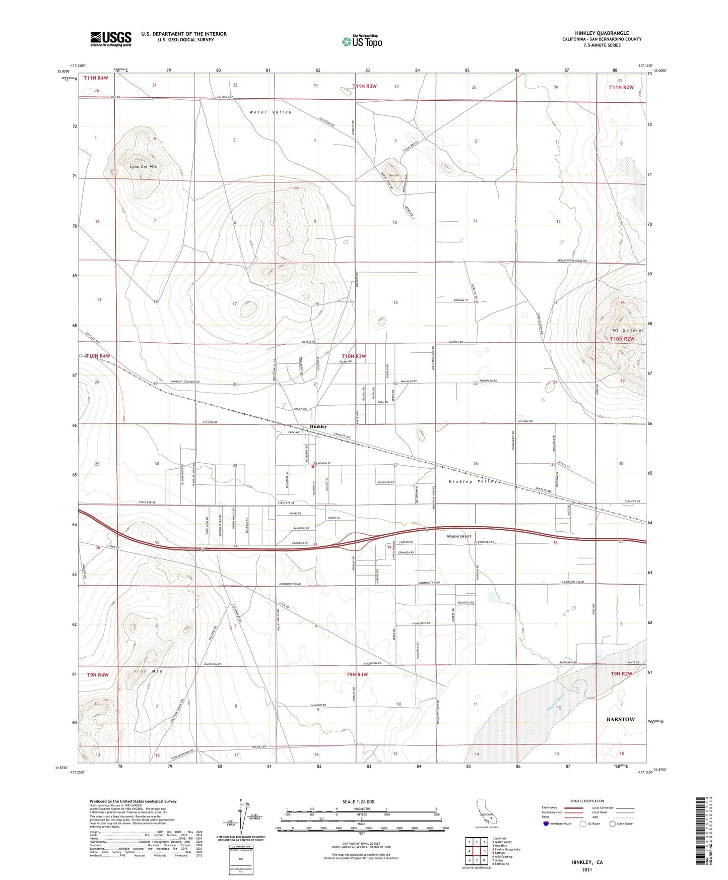
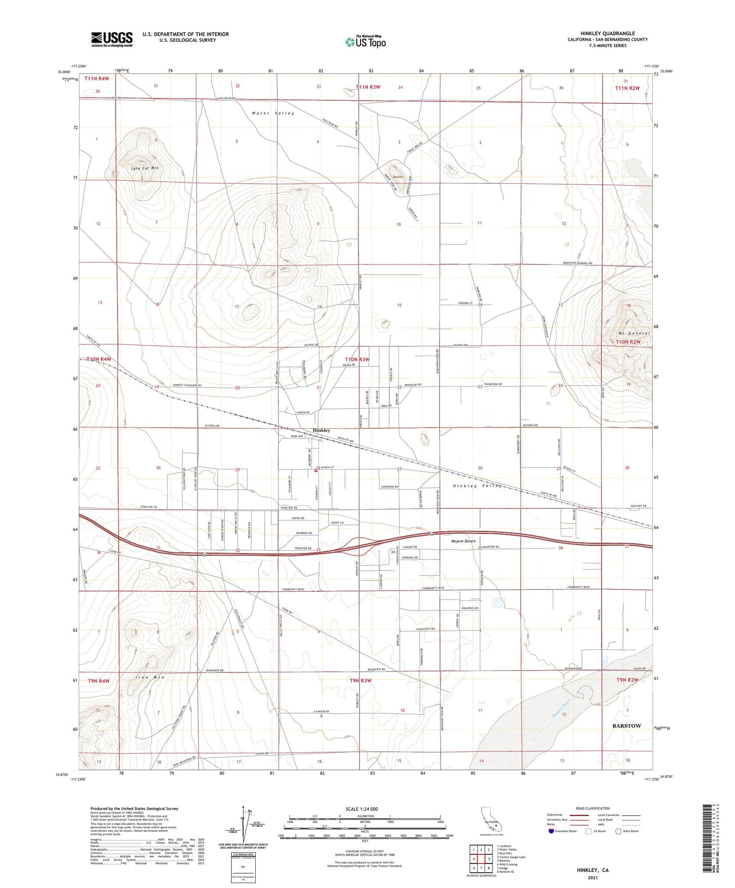
2021 topographic map quadrangle Hinkley in the state of California. Scale: 1:24000. Based on the newly updated USGS 7.5' US Topo map series, this map is in the following counties: San Bernardino. The map contains contour data, water features, and other items you are used to seeing on USGS maps, but also has updated roads and other features. This is the next generation of topographic maps. Printed on high-quality waterproof paper with UV fade-resistant inks.
Quads adjacent to this one:
West: Twelve Gauge Lake
Northwest: Lockhart
North: Water Valley
Northeast: Mud Hills
East: Barstow
Southeast: Barstow SE
South: Hodge
Southwest: Wild Crossing
This map covers the same area as the classic USGS quad with code o34117h2.
Contains the following named places: First Baptist Church of Hinkley, Hinkley, Hinkley Elementary-Middle School, Hinkley Post Office, Hinkley Valley, Hinkley Valley Grange, Lynx Cat Mountain, Mount General, Pedry Mine, Red Hill, San Bernardino County Fire Department Station 56 Hinkley, ZIP Code: 92347