
MyTopo
Logandale California US Topo Map
Couldn't load pickup availability
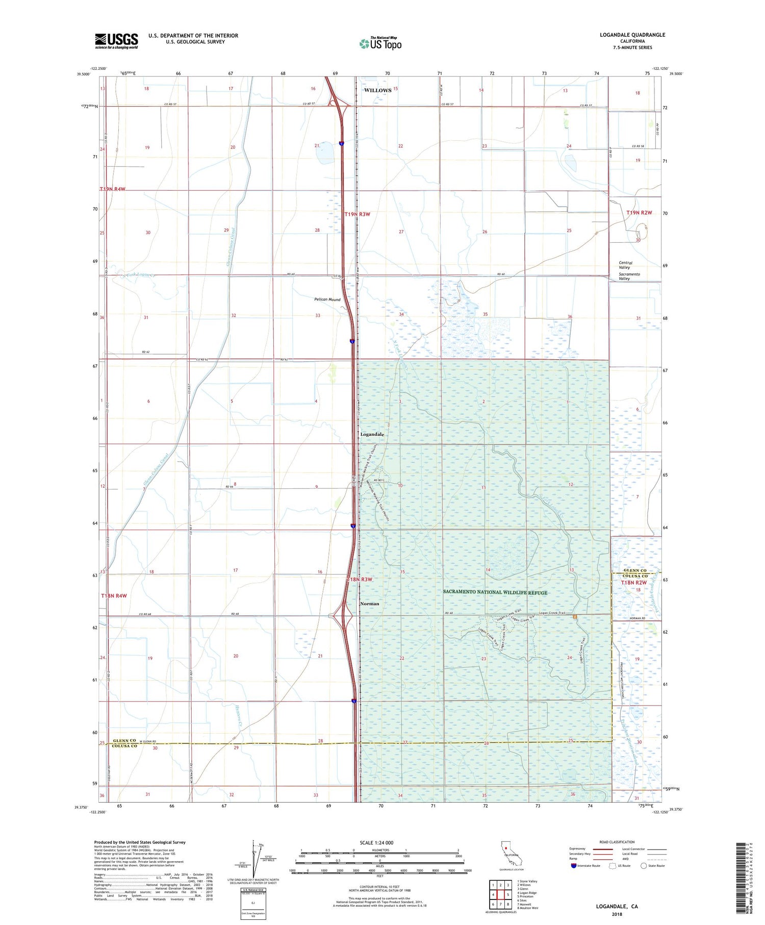
2022 topographic map quadrangle Logandale in the state of California. Scale: 1:24000. Based on the newly updated USGS 7.5' US Topo map series, this map is in the following counties: Glenn, Colusa. The map contains contour data, water features, and other items you are used to seeing on USGS maps, but also has updated roads and other features. This is the next generation of topographic maps. Printed on high-quality waterproof paper with UV fade-resistant inks.
Quads adjacent to this one:
West: Logan Ridge
Northwest: Stone Valley
North: Willows
Northeast: Glenn
East: Princeton
Southeast: Moulton Weir
South: Maxwell
Southwest: Sites
This map covers the same area as the classic USGS quad with code o39122d2.
Contains the following named places: Liberty School, Logandale, Minor Farm, Norman, North Fork Logan Creek, Pelican Mound, Peratis Duck Club, Provident Western Canal, Riz Siding, Sacramento National Wildlife Refuge


