MyTopo
Lone Tree Well California US Topo Map
Couldn't load pickup availability
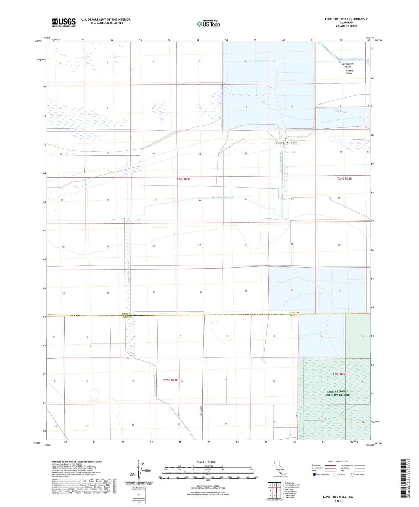
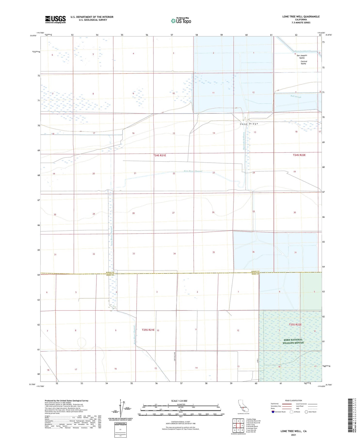
2021 topographic map quadrangle Lone Tree Well in the state of California. Scale: 1:24000. Based on the newly updated USGS 7.5' US Topo map series, this map is in the following counties: Kings, Kern. The map contains contour data, water features, and other items you are used to seeing on USGS maps, but also has updated roads and other features. This is the next generation of topographic maps. Printed on high-quality waterproof paper with UV fade-resistant inks.
Quads adjacent to this one:
West: West Camp
Northwest: Dudley Ridge
North: Hacienda Ranch NW
Northeast: Hacienda Ranch NE
East: Hacienda Ranch
Southeast: Lost Hills NE
South: Lost Hills NW
Southwest: Antelope Plain
This map covers the same area as the classic USGS quad with code o35119g6.
Contains the following named places: Burhans Ranch, Hacienda Spillway, Kern River Channel, Lone Tree Well, Sand Ridge, Sandoll Ranch