MyTopo
Ninemile Wash California US Topo Map
Couldn't load pickup availability
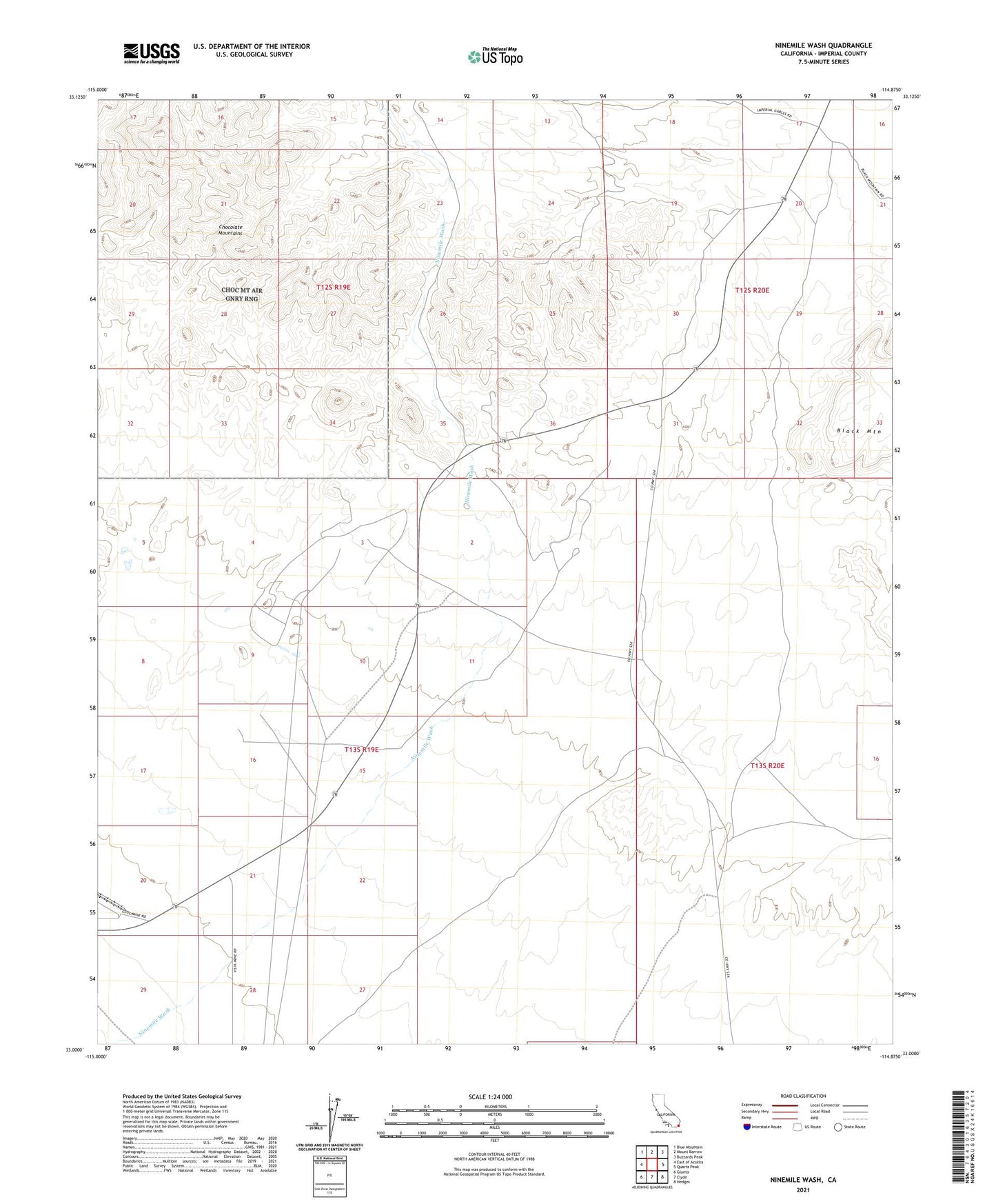
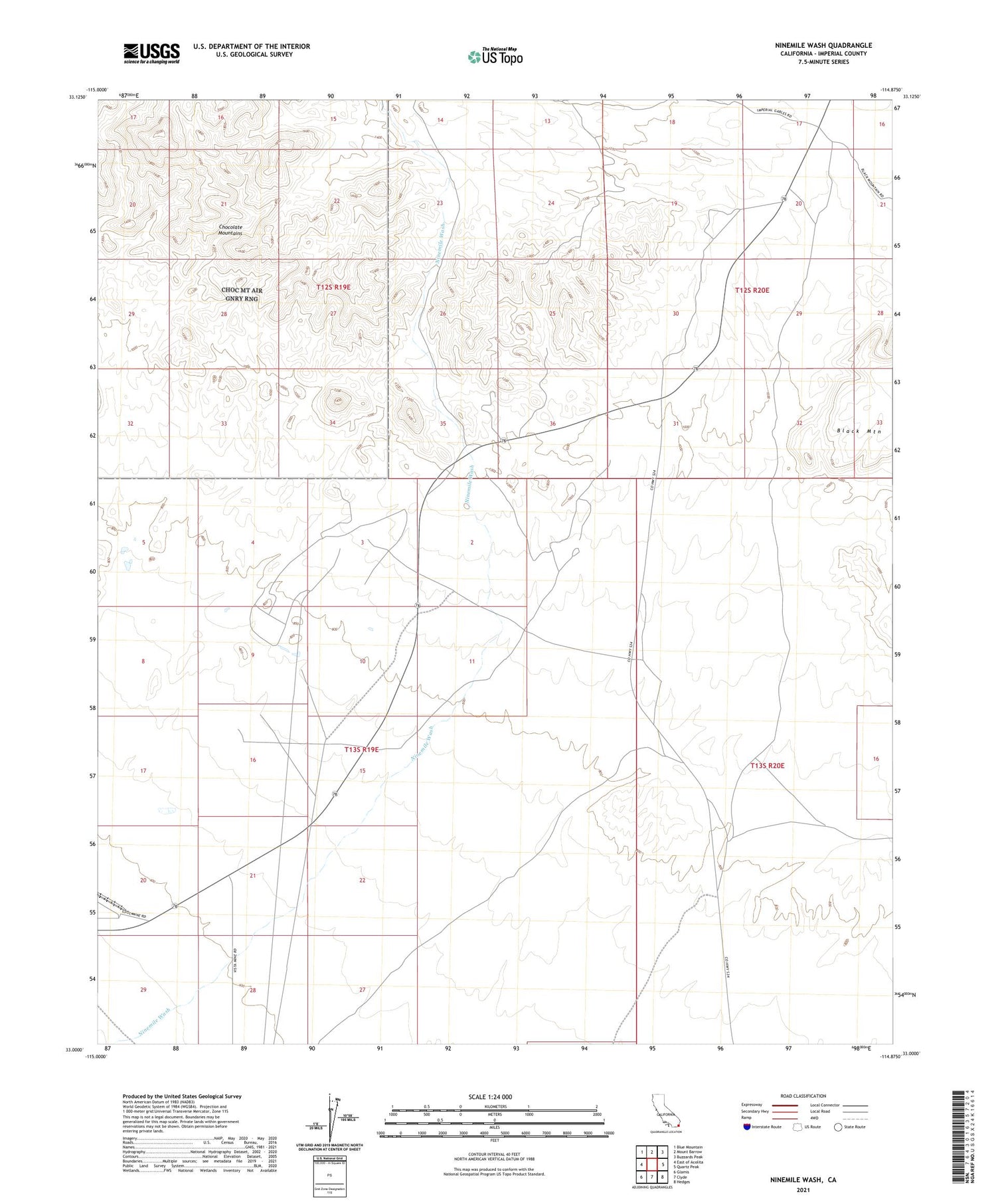
2021 topographic map quadrangle Ninemile Wash in the state of California. Scale: 1:24000. Based on the newly updated USGS 7.5' US Topo map series, this map is in the following counties: Imperial. The map contains contour data, water features, and other items you are used to seeing on USGS maps, but also has updated roads and other features. This is the next generation of topographic maps. Printed on high-quality waterproof paper with UV fade-resistant inks.
Quads adjacent to this one:
West: East of Acolita
Northwest: Blue Mountain
North: Mount Barrow
Northeast: Buzzards Peak
East: Quartz Peak
Southeast: Hedges
South: Clyde
Southwest: Glamis
Contains the following named places: Glamis Pit, Mesquite Mine, Ninemile Wash, Old Channel Mine Shaft, Rainbow Mine, Vista Mine